展望・ランドマーク
マルセロ・フェルナン橋
Marcelo Fernan Bridge
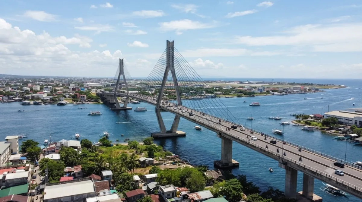
マルセロ・フェルナン橋 はフィリピンにある長大なプレストレスト・コンクリート橋(エクストラドーズド橋)。マクタン・セブ国際空港やビーチリゾートのあるマクタン島のラプ=ラプ市と、セブ島のマンダウエ市とを結ぶ。セブ市を中心とするフィリピン第二の大都市圏メトロ・セブの交通網の一部をなす。第二セブ・マクタン橋 とも呼ばれる。
What it is
The Marcelo Fernan Bridge is a cable-stayed bridge spanning the Mactan Channel, linking Mandaue on the main island of Cebu with Lapu-Lapu City on Mactan Island. It's the second of the crossings connecting the two islands, running alongside the older Mactan-Mandaue Bridge nearby. Travellers usually cross it as part of getting between mainland Cebu and Mactan's resorts and airport, rather than visiting it as a standalone destination, though its cable-stayed towers make it a recognizable landmark when viewed from the water or the shoreline on either side.
Getting there
The bridge sits within Metro Cebu, roughly a 20-30 minute drive from Cebu City's centre depending on traffic, and is easily reached by taxi, ride-hailing app, or private vehicle. It also lies close to Mactan-Cebu International Airport (CEB), making it a natural point of passage when heading to or from the airport.
How much time to allow
Most people simply drive or ride across it in a few minutes as part of a longer trip. If you want to stop and view or photograph the bridge from a vantage point along the channel, allow an extra 20-30 minutes.
When to go
Traffic across the bridge can build up during weekday rush hours in the morning and late afternoon, so travelling outside those windows makes for a smoother crossing. For photos, early morning or late afternoon light tends to show the cable towers well.
What to combine it with
Since the bridge connects to Mactan Island, it pairs naturally with a visit to Mactan (3 km) and historical sites tied to the island's colonial history, including the Lapulapu Monument (5.6 km) and Liberty Shrine (5.6 km), both commemorating the Battle of Mactan. Magellan Bay (5.5 km) is also within easy reach for those tracing the same history.
出典:ウィキペディア・OpenStreetMap の公開データ · 2026年8月5日 更新 · 編集 World by City 編集部