Natur
Cái Nha Trang River
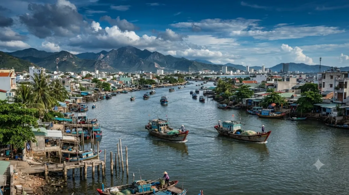
Der Fluss Cái in Nha Trang
Der Fluss fließt durch die Provinz Khanh Hoa und die Stadt Nha Trang, bevor er ins Meer mündet. Er entwässert ein Becken von 1.904 Quadratkilometern. Reisende besuchen das Flussufer, um den lokalen Alltag abseits der Strände zu beobachten. Entlang des Flusslaufs finden sich Brücken, Fischerboote und kleine Siedlungen.
Anreise und Dauer
Da der Fluss direkt durch das Stadtzentrum führt, ist er von dort aus in wenigen Minuten zu Fuß oder mit einem kurzen Taxifahrt erreichbar. Die Zeit für einen Spaziergang entlang der Ufer oder eine kurze Beobachtung des Treibens beträgt in der Regel ein bis zwei Stunden.
Beste Besuchszeit
Ein Besuch in den frühen Morgenstunden oder am späten Nachmittag ist empfehlenswert, um die Aktivitäten der lokalen Fischer zu sehen und der Mittagshitze zu entgehen. In den Hauptreisezeiten kann es an den zugänglichen Uferabschnitten belebt sein.
Kombinationsmöglichkeiten
Aufgrund der zentralen Lage lassen sich weitere Sehenswürdigkeiten in die Route integrieren:
- Long Sơn Pagoda: ca. 2 km entfernt
- Po Nagar: ca. 2,2 km entfernt
- Römisch-katholische Diözese Nha Trang: ca. 2,8 km entfernt
- Christ the King Cathedral: ca. 2,8 km entfernt
Aktualisiert 20. September 2026 · Redaktion die World by City-Redaktion
 GetYourGuide
 Klook
Klook
 Tiqets
 KKday
KKday
 WeGoTrip
 Booking.com
 Hotels.com