World by City

자연

Olango Island

Olango Island

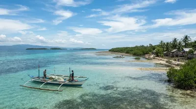
The Olango Island Group is a group of islands found in the Central Visayas region of the Philippines. It comprises Olango island and 6 satellite islets namely: Caubian, Camungi, Caohagan, Gilutongan, Nalusuan, Pangan-an, and Sulpa. The island group has a total land area of approximately 1,030 hectares. It is divided under the jurisdiction of the city of Lapu-Lapu and the municipality of Cordova, Cebu. It lies 5 kilometers (3.1 mi) east of Mactan and is a major tourist destination in Cebu. It is known for its wildlife sanctuary. The entire area is the first declared Ramsar Wetland Site in the P...

올랑고 섬 (Olango Island)

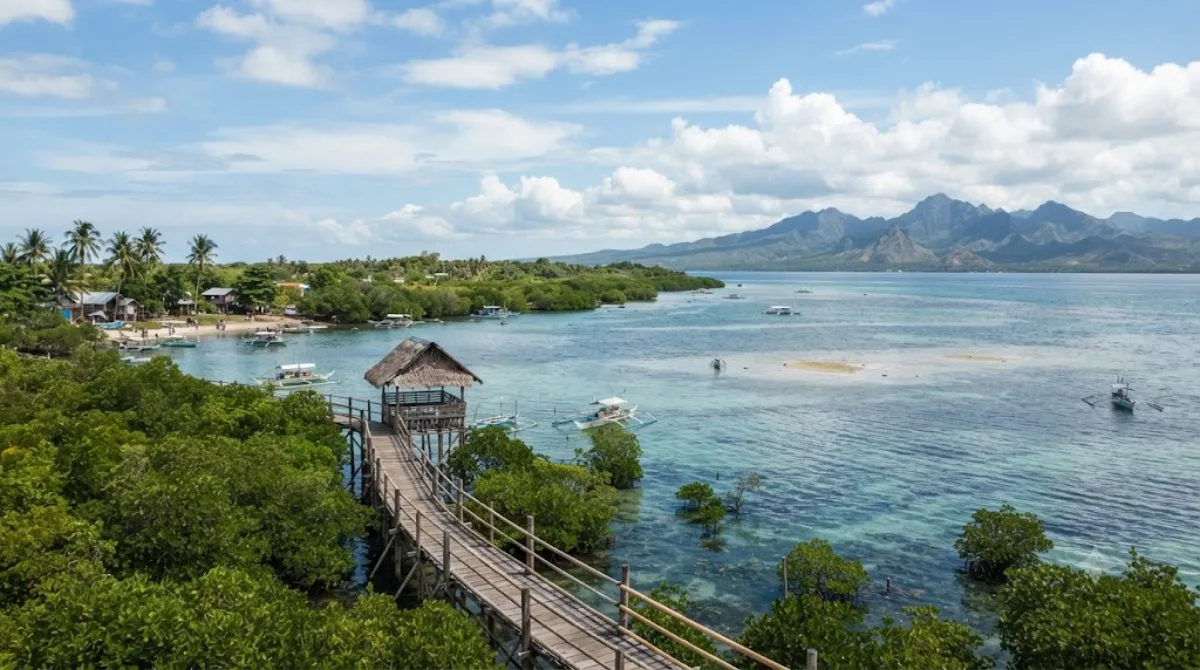
올랑고 섬은 막탄 섬에서 동쪽으로 약 5km 떨어진 곳에 위치한 작은 섬으로, 올랑고, 카우비안, 카뭉이, 카오하간, 힐루통안, 날루산, 팡간안, 술파 등 7개의 섬으로 이루어진 섬 무리 중 가장 큰 섬이다. 필리핀에서 최초로 람사르 습지로 지정된 지역에 속해 있으며, 맹그로브 습지와 갯벌이 발달해 철새들이 머무는 야생동물 보호구역으로 알려져 있다. 자연 그대로의 해안선과 조류 관찰, 스노클링·다이빙 포인트를 찾는 여행자들이 주로 찾는다.

가는 방법

세부 시내에서는 먼저 막탄 섬으로 이동한 뒤, 막탄 동쪽 해안의 선착장에서 통가배(방카)를 타고 올랑고 섬으로 건너간다. 세부 시내에서 막탄 선착장까지는 차로 30~40분 정도 걸리고, 바다를 건너는 시간은 20~30분 안팎이다. 막탄 세부 국제공항(CEB)에서 출발한다면 이동 거리가 더 짧다.

머무는 시간

야생동물 보호구역 탐방과 주변 섬 스노클링을 함께 할 경우 반나절에서 하루 정도 여유를 두는 것이 좋다.

언제 가면 좋은지

철새는 계절에 따라 도래 시기가 다르므로 조류 관찰이 목적이라면 사전에 시기를 확인하는 것이 좋다. 물때에 따라 갯벌이 드러나는 정도가 달라져 보트 이동이나 해안 접근이 영향을 받을 수 있다. 주말이나 성수기에는 방카 선착장이 붐빌 수 있다.

함께 둘러보기

  • 올랑고 섬 무리(0.8km): 힐루통안, 날루산 등 인근 위성 섬으로 이어서 스노클링이나 섬 호핑을 이어가기 좋다.
  • 막탄 섬 쪽으로 나와 마젤란 기념비(6.7km), 리버티 신전(6.8km), 라푸라푸 기념비(6.8km)를 함께 묶어 막탄의 역사 유적을 둘러볼 수 있다.

출처: 위키백과·OpenStreetMap 공개 자료 · 갱신 2026년 8월 5일 · 편집 World by City 편집팀

입장권·투어 예약

입장료와 운영 시간은 자주 바뀌어서 여기 적지 않습니다. 아래에서 지금 판매 중인 티켓과 가격을 확인하세요. 미리 사두면 현장 대기를 줄일 수 있는 곳도 있어요.

검색 결과에 이 장소의 티켓이 없을 수도 있어요. 무료 입장이거나 현장 발권만 하는 곳도 있습니다.

Olango Island 근처 숙소

걸어서 오갈 수 있는 거리부터 가까운 순으로 정리했어요. 거리는 직선거리 기준입니다.

지도 © OpenStreetMap 기여자. 직선 연결이라 실제 이동 경로와는 다릅니다.

Olango Island 근처 숙소

숙소 위치·이름은 OpenStreetMap 자료를 기반으로 하며, 가격과 예약 가능 여부는 각 예약 사이트에서 확인해 주세요.

같이 둘러보기 좋은 곳

Olango Island Group

자연

Olango Island Group

The Olango Island Group is a group of islands found in the Central Visayas region of the Philippines. It comprises Olango island and 6 satellite islets namely: Caubian, Camungi, Caohagan, Gilutongan, Nalusuan, Pangan-an, and Sulpa. The island group has a total land area of approximately 1,030 hectares. It is divided under the jurisdiction of the city of Lapu-Lapu and the municipality of Cordova, Cebu. It lies 5 kilometers (3.1 mi) east of Mactan and is a major tourist destination in Cebu. It is known for its wildlife sanctuary. The entire area is the first declared Ramsar Wetland Site in the P...

여기서 0.8 km

Magellan Monument

유적·기념물

Magellan Monument

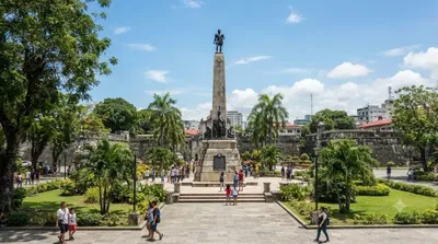
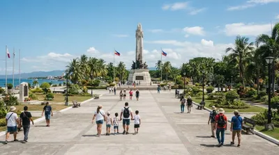
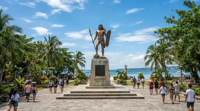
Mactan Shrine, also known as Liberty Shrine or Lapulapu Monument, is a memorial park on the island of Mactan in Lapu-Lapu City, Philippines. It hosts two monuments—the Magellan Monument, which is dedicated to Portuguese born explorer Ferdinand Magellan, and the Lapu Lapu Monument, a bronze statue which commemorates Lapu Lapu, a native leader who defeated Spanish soldiers led by Magellan in the 1521 Battle of Mactan.

여기서 6.7 km

Liberty Shrine

공원·정원

Liberty Shrine

Mactan Shrine, also known as Liberty Shrine or Lapulapu Monument, is a memorial park on the island of Mactan in Lapu-Lapu City, Philippines. It hosts two monuments—the Magellan Monument, which is dedicated to Portuguese born explorer Ferdinand Magellan, and the Lapu Lapu Monument, a bronze statue which commemorates Lapu Lapu, a native leader who defeated Spanish soldiers led by Magellan in the 1521 Battle of Mactan.

여기서 6.8 km

Lapulapu Monument

유적·기념물

Lapulapu Monument

Mactan Shrine, also known as Liberty Shrine or Lapulapu Monument, is a memorial park on the island of Mactan in Lapu-Lapu City, Philippines. It hosts two monuments—the Magellan Monument, which is dedicated to Portuguese born explorer Ferdinand Magellan, and the Lapu Lapu Monument, a bronze statue which commemorates Lapu Lapu, a native leader who defeated Spanish soldiers led by Magellan in the 1521 Battle of Mactan.

여기서 6.8 km

Magellan Bay

자연

Magellan Bay

Magellan Bay is a bay located northeast of Mactan Island, near the city of Lapu-Lapu in the Philippines. The bay is named after the Portuguese explorer Ferdinand Magellan, who was killed in this area by the forces of Lapu-Lapu.

여기서 8.7 km

Pandanon Island

자연

Pandanon Island

Pandanon is an island located in the Camotes Sea, in between the islands of Olango and Bohol, in the Visayas Region, Philippines. The island is locally administered by Barangay Pandanon, municipality of Getafe, Bohol. Pandanon is situated in the Danajon Bank, the only double barrier reef in the country and famous for its rich marine wildlife and diversity. It is 9 km (5.6 mi) northwest of the port of Getafe and 13 km (8.1 mi) southeast of Cordova, Cebu. While most of the residents in the island engage in fishing, some are employed in the tourism sector, working in the beach resorts of the isla...

여기서 10.1 km