World by City

유적·기념물

세이화우타키

Sefa-utaki

세이화우타키

Sefa-utaki, is a historical sacred space, overlooking Kudaka Island, that served as one of the key locations of worship in the native religion of Ryukyuan for millennia. It was designated a National Historic Site in 2018. It is part of the UNESCO World Heritage Site Gusuku Sites and Related Properties of the Kingdom of Ryukyu in the city of Nanjō, Okinawa, Japan.

세화 우타키란

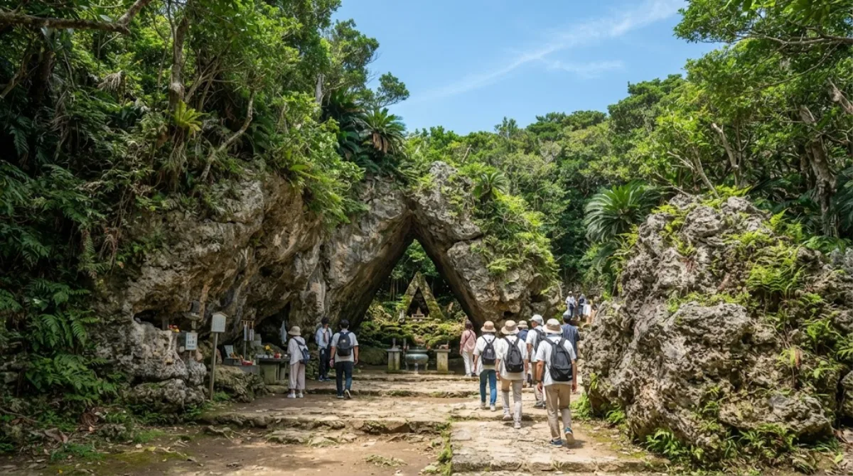
세화 우타키는 류큐 왕국 시대부터 이어져 온 류큐 토착 신앙의 성지로, 구다카섬을 바라보는 숲속에 자리하고 있습니다. 신사처럼 인공적으로 조성된 건축물이 아니라 바위와 숲 그 자체를 신성한 공간으로 여겨온 곳이라, 삼각형 모양의 바위 틈을 지나는 산구이 우타키 등 자연 지형이 신앙의 대상이 되어온 흔적을 직접 볼 수 있습니다. 2018년 국가 사적으로 지정되었고, 류큐 왕국의 구스쿠 유적군으로 유네스코 세계유산에도 포함되어 있습니다.

가는 방법

나하 시내에서 차로 약 40km 떨어져 있으며, 자동차나 렌터카로 1시간 안팎이 걸립니다. 대중교통을 이용할 경우 나하 버스터미널에서 난조 시 방면 버스를 타고 이동한 뒤 도보로 접근해야 하며, 배차 간격이 넓은 편이라 시간을 넉넉히 잡는 것이 좋습니다.

둘러보는 데 걸리는 시간

숲길을 따라 주요 지점을 돌아보는 데 1시간에서 1시간 30분 정도면 충분합니다. 산책로는 자연 지형 그대로인 구간이 많아 걷는 데 여유를 두는 편이 좋습니다.

방문 시 참고할 점

숲으로 둘러싸인 오르막 산책로라 여름철에는 습하고 더위를 느끼기 쉬우며, 비가 온 뒤에는 바닥이 미끄러울 수 있어 걷기 편한 신발이 필요합니다. 성지인 만큼 조용히 둘러보는 분위기가 유지되며, 단체 관광객이 몰리는 시간대에는 산책로가 붐빌 수 있습니다.

주변 명소와 함께

  • 구다카섬(6.2km): 세화 우타키에서 바라보이는 신앙의 섬으로 함께 둘러보기 좋습니다.
  • 오지마(7.3km)
  • 교쿠센도(8.5km): 종유동굴을 함께 볼 수 있습니다.
  • 나카구스쿠만(8.7km)

이들 명소는 모두 난조시 인근에 모여 있어 세화 우타키와 함께 하루 일정으로 묶어 이동하기에 무리가 없습니다.

출처: 위키백과·OpenStreetMap 공개 자료 · 갱신 2026년 8월 5일 · 편집 World by City 편집팀

입장권·투어 예약

입장료와 운영 시간은 자주 바뀌어서 여기 적지 않습니다. 아래에서 지금 판매 중인 티켓과 가격을 확인하세요. 미리 사두면 현장 대기를 줄일 수 있는 곳도 있어요.

검색 결과에 이 장소의 티켓이 없을 수도 있어요. 무료 입장이거나 현장 발권만 하는 곳도 있습니다.

세이화우타키 근처 숙소

걸어서 오갈 수 있는 거리부터 가까운 순으로 정리했어요. 거리는 직선거리 기준입니다.

지도 © OpenStreetMap 기여자. 직선 연결이라 실제 이동 경로와는 다릅니다.

세이화우타키 근처 숙소

숙소 위치·이름은 OpenStreetMap 자료를 기반으로 하며, 가격과 예약 가능 여부는 각 예약 사이트에서 확인해 주세요.

같이 둘러보기 좋은 곳

Kudaka Island

자연

Kudaka Island

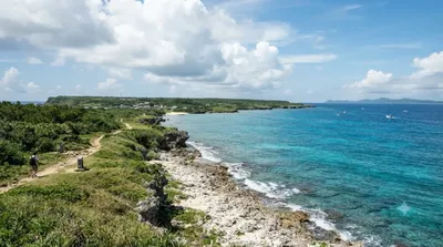
Kudaka Island is an island in Ryukyu Islands, located in Nanjō, Okinawa Prefecture, Japan and 5.3 kilometers away from Cape Chinen, Nanjō. From Nanjō, Kudaka Island can be reached by high-speed boat in 15 minutes and by ferry in 20 minutes. It is only about three miles off the southeast coast of Okinawa.

여기서 6.2 km

Ou Island

자연

Ou Island

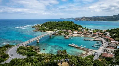
Ou Island is a small islet located in the Okinawa Islands of Japan. It's administered by the town of Nanjō, and a bridge connects both entities.

여기서 7.3 km

교쿠센도

자연

교쿠센도

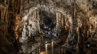
교쿠센도(일본어: 玉泉洞)는 일본 오키나와현 난조시에 있는 석회암 동굴이다. 동굴군의 일부는 오키나와 월드의 일부로서 공개되어 있다.

여기서 8.5 km

Nakagusuku Bay

자연

Nakagusuku Bay

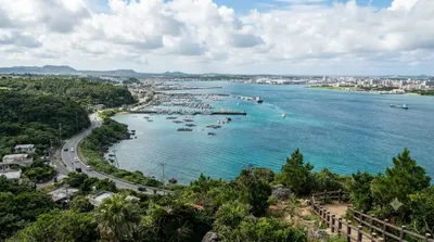
Nakagusuku Bay is a bay on the southern coast of Okinawa Island on the Pacific Ocean in Japan. The bay covers 220 square kilometres (85 sq mi) and ranges between 10 metres (33 ft) to 15 metres (49 ft) deep. The bay is surrounded by the municipalities of Uruma, Kitanakagusuku, Nakagusuku, Nishihara, Yonabaru, Nanjō, all in Okinawa Prefecture. In 1852, while visiting the Ryukyu Kingdom, Commodore Matthew Perry mapped Okinawa and labeled Nakagusuku Bay as "Perry's Bay". During the final months of World War II, the bay became a United States Navy forward base and was nicknamed "Buckner Bay".

여기서 8.7 km

Kokuba River

자연

Kokuba River

The Kokuba River is a river in Naha, Okinawa, and is the hydrographic resource for domestic urban fresh water. A number of geographical places on Okinawa bear its name, such as Lake Man Park (漫湖公園) and Kokuba Danchi (国場団地). The river flows into the East China Sea.

여기서 9.5 km

Okinawa Shrine

사원·종교

Okinawa Shrine

Okinawa Shrine is a Shinto shrine in Naha, Okinawa Prefecture, Japan. Established at the end of the Taishō period on the site of Shuri Castle, the main hall of which was reused as the haiden, the shrine buildings were destroyed in May 1945 during the Battle of Okinawa. Both castle and shrine have since been rebuilt while this phase has been written out of the "official history" currently told at Shurijō Castle Park.

여기서 10.7 km