World by City

Denkmäler & Ausgrabungen

Seifa Utaki

Sefa-utaki
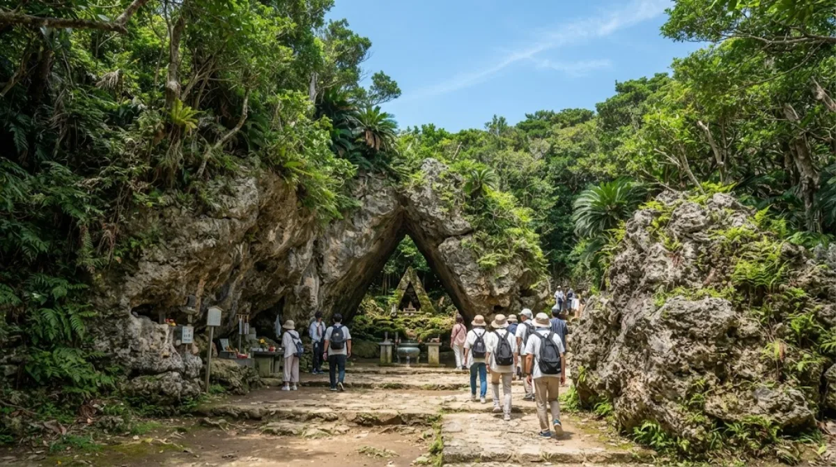
Seifa Utaki

Seifa Utaki ist eine der heiligsten religiösen Stätten der Ryūkyū-Inseln, gelegen auf der Chinen-Halbinsel im südlichen Okinawa, Japan. Die Stätte gilt als zentrales Heiligtum der traditionellen Religion der Ryūkyū und ist ein wichtiger Ort für Ahnenverehrung, Naturreligion und rituelle Zeremonien.

What it is

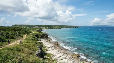
Sefa-utaki is a forested sacred site on a hillside overlooking Kudaka Island, used for centuries as a place of worship in the native Ryukyuan religion. Unlike most historic sites in Okinawa, there are no reconstructed buildings here — the draw is a series of natural rock formations and worship spaces set among trees, including a striking triangular passage formed by two large boulders leaning against each other. It's included in the UNESCO World Heritage listing for Gusuku Sites and Related Properties of the Kingdom of Ryukyu, and travellers go for the atmosphere and the view toward Kudaka Island rather than for any single monument.

Getting there

Sefa-utaki is in Nanjō, on the southern part of Okinawa's main island, away from central Naha. There's no direct train service; the practical options are renting a car or joining a tour, with driving from central Naha taking roughly 40-50 minutes depending on traffic. A bus connection exists but typically involves a transfer and takes longer than driving.

How much time to allow

Plan for around 1 to 1.5 hours, including a walk through the wooded path to the main worship sites and the viewpoint over Kudaka Island. The path involves some walking on uneven natural terrain and a bit of elevation change.

When to go

Go earlier in the day if possible — the forest walk offers little shade relief from midday heat, and Okinawa summers can be humid. As a UNESCO-listed site, it draws steady visitor numbers, including tour groups, so early morning tends to be quieter than midday.

Combine it with

  • Kudaka Island (6.2km) — the island visible from Sefa-utaki's viewpoint, itself considered sacred in Ryukyuan tradition.
  • Ou Island (7.3km) — a short distance further, reachable as part of the same southern Okinawa itinerary.
  • Gyokusendō (8.5km) — a limestone cave system, a common pairing for a full day exploring southern Okinawa.
  • Nakagusuku Bay (8.7km) — coastal scenery nearby if extending the trip further.

Quellen: offene Daten von Wikipedia und OpenStreetMap · Aktualisiert 5. August 2026 · Redaktion die World by City-Redaktion

Tickets & Touren

Eintrittspreise und Öffnungszeiten ändern sich häufig und stehen daher nicht hier. Unten sehen Sie, was gerade angeboten wird – vorab buchen spart mancherorts Wartezeit.

Dieser Ort erscheint womöglich nicht in den Ergebnissen – manche Ziele sind kostenlos oder verkaufen nur vor Ort.

Unterkünfte nahe Seifa Utaki

Nach Entfernung sortiert, fußläufige zuerst. Angaben als Luftlinie.

Karte © OpenStreetMap-Mitwirkende. Linien sind Luftlinien, keine echten Routen.

Seifa Utaki Unterkünfte in der Nähe

Lage und Namen stammen aus OpenStreetMap. Preise und Verfügbarkeit bitte auf den Buchungsseiten prüfen.

Passt gut dazu

Kudaka Island

Natur

Kudaka Island

Kudaka Island is an island in Ryukyu Islands, located in Nanjō, Okinawa Prefecture, Japan and 5.3 kilometers away from Cape Chinen, Nanjō. From Nanjō, Kudaka Island can be reached by high-speed boat in 15 minutes and by ferry in 20 minutes. It is only about three miles off the southeast coast of Okinawa.

6.2 km entfernt

Ou Island

Natur

Ou Island

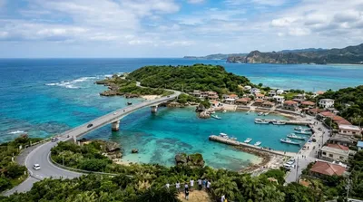
Ou Island is a small islet located in the Okinawa Islands of Japan. It's administered by the town of Nanjō, and a bridge connects both entities.

7.3 km entfernt

교쿠센도

Natur

교쿠센도

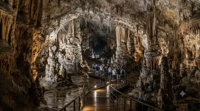
교쿠센도(일본어: 玉泉洞)는 일본 오키나와현 난조시에 있는 석회암 동굴이다. 동굴군의 일부는 오키나와 월드의 일부로서 공개되어 있다.

8.5 km entfernt

Nakagusuku Bay

Natur

Nakagusuku Bay

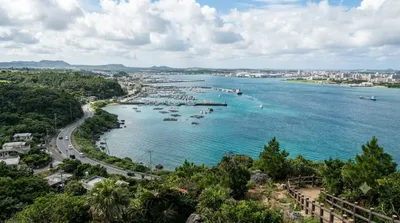
Nakagusuku Bay is a bay on the southern coast of Okinawa Island on the Pacific Ocean in Japan. The bay covers 220 square kilometres (85 sq mi) and ranges between 10 metres (33 ft) to 15 metres (49 ft) deep. The bay is surrounded by the municipalities of Uruma, Kitanakagusuku, Nakagusuku, Nishihara, Yonabaru, Nanjō, all in Okinawa Prefecture. In 1852, while visiting the Ryukyu Kingdom, Commodore Matthew Perry mapped Okinawa and labeled Nakagusuku Bay as "Perry's Bay". During the final months of World War II, the bay became a United States Navy forward base and was nicknamed "Buckner Bay".

8.7 km entfernt

Kokuba River

Natur

Kokuba River

The Kokuba River is a river in Naha, Okinawa, and is the hydrographic resource for domestic urban fresh water. A number of geographical places on Okinawa bear its name, such as Lake Man Park (漫湖公園) and Kokuba Danchi (国場団地). The river flows into the East China Sea.

9.5 km entfernt

Okinawa Shrine

Tempel & Sakralbauten

Okinawa Shrine

Okinawa Shrine is a Shinto shrine in Naha, Okinawa Prefecture, Japan. Established at the end of the Taishō period on the site of Shuri Castle, the main hall of which was reused as the haiden, the shrine buildings were destroyed in May 1945 during the Battle of Okinawa. Both castle and shrine have since been rebuilt while this phase has been written out of the "official history" currently told at Shurijō Castle Park.

10.7 km entfernt