World by City

Natur

교쿠센도

Gyokusendō

교쿠센도

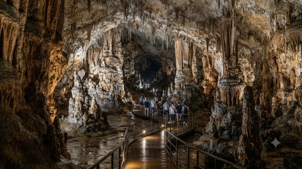
교쿠센도(일본어: 玉泉洞)는 일본 오키나와현 난조시에 있는 석회암 동굴이다. 동굴군의 일부는 오키나와 월드의 일부로서 공개되어 있다.

Overview

Gyokusendō is a limestone cave in Nanjo City, on the southern part of Okinawa's main island. It's known for its dense concentration of stalactites and stalagmites, formed over a very long period, and a section of the cave system is developed as a walkable route within the Okinawa World theme park complex. Travellers come mainly for the underground rock formations rather than for any above-ground attractions at the site.

Getting there

From central Naha, the cave is reachable by car or taxi in around 30-40 minutes, depending on traffic. There are also direct bus services from Naha to Okinawa World, though schedules should be checked in advance since services can be infrequent. Public transport connections in this part of Okinawa are limited, so many visitors rent a car for the day.

How much time to allow

The cave walk itself typically takes under an hour, but since it sits within the larger Okinawa World complex, allow a half-day if you plan to see other parts of the park as well.

When to go

Inside the cave, temperature and humidity stay fairly constant year-round, so it can be a comfortable option during Okinawa's hot summer months. The walkway can feel narrow and busy when tour groups pass through, so arriving earlier in the day may mean a quieter walk. Paths inside can be damp and slightly slippery in places.

Combine with

  • Ou Island (2.3km) is close enough to pair with a cave visit on the same trip.
  • Okinawa Prefectural Peace Memorial Museum (5.3km) and Himeyuri Peace Museum (7.6km) are within a short drive and often visited together as part of southern Okinawa's war history sites.
  • Kokuba River (7.1km) is another option nearby if you're exploring further toward Naha.

Quellen: offene Daten von Wikipedia und OpenStreetMap · Aktualisiert 5. August 2026 · Redaktion die World by City-Redaktion

Tickets & Touren

Eintrittspreise und Öffnungszeiten ändern sich häufig und stehen daher nicht hier. Unten sehen Sie, was gerade angeboten wird – vorab buchen spart mancherorts Wartezeit.

Dieser Ort erscheint womöglich nicht in den Ergebnissen – manche Ziele sind kostenlos oder verkaufen nur vor Ort.

Unterkünfte nahe 교쿠센도

Nach Entfernung sortiert, fußläufige zuerst. Angaben als Luftlinie.

Karte © OpenStreetMap-Mitwirkende. Linien sind Luftlinien, keine echten Routen.

교쿠센도 Unterkünfte in der Nähe

Lage und Namen stammen aus OpenStreetMap. Preise und Verfügbarkeit bitte auf den Buchungsseiten prüfen.

Passt gut dazu

Ou Island

Natur

Ou Island

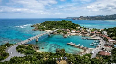
Ou Island is a small islet located in the Okinawa Islands of Japan. It's administered by the town of Nanjō, and a bridge connects both entities.

2.3 km entfernt

Okinawa Prefectural Peace Memorial Museum

Museen & Galerien

Okinawa Prefectural Peace Memorial Museum

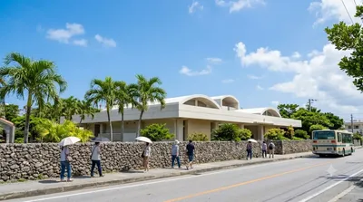
Okinawa Prefectural Peace Memorial Museum is a museum in Itoman, Okinawa. It was established on June 11, 1975. The Cornerstone of Peace, a monument similar to the Vietnam Veterans Memorial, is located here.

5.3 km entfernt

Kokuba River

Natur

Kokuba River

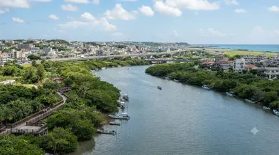
The Kokuba River is a river in Naha, Okinawa, and is the hydrographic resource for domestic urban fresh water. A number of geographical places on Okinawa bear its name, such as Lake Man Park (漫湖公園) and Kokuba Danchi (国場団地). The river flows into the East China Sea.

7.1 km entfernt

Himeyuri-Friedensmuseum

Museen & Galerien

Himeyuri-Friedensmuseum

Das Himeyuri-Friedensmuseum wurde am 23. Juni 1989 in Itoman auf Okinawa eröffnet. Die Gedenkstätte erinnert an das Schicksal des Himeyuri-Schülerinnentrupps. Während der Schlacht um Okinawa wurde eine Hilfstruppe gebildet, die aus 222 Schülerinnen und 18 Lehrern bestand. 134 Schülerinnen und Lehrer dieses Sanitätstrupps verloren bei den Kämpfen auf Okinawa ihr Leben.

7.6 km entfernt

Okinawa Senseki Quasi-Nationalpark

Parks & Gärten

Okinawa Senseki Quasi-Nationalpark

Der Okinawa-Senseki-Quasi-Nationalpark ist einer von über 50 Quasi-Nationalparks in Japan. Die Präfektur Okinawa ist für die Verwaltung des Parks zuständig. Der Park wurde am 15. Mai 1972 ernannt und umfasst insgesamt eine Fläche von ca. 5060 ha, bestehend aus einer Landfläche von ca. 3127 ha und einer Wasserfläche von 1930 ha. Mit der IUCN-Kategorie V ist das Parkgebiet als Geschützte Landschaft/Geschütztes Marines Gebiet klassifiziert.

7.7 km entfernt

Shikinaen

Parks & Gärten

Shikinaen

Shikinaen ist ein historischer Landschaftsgarten und UNESCO-Weltkulturerbe in Naha, Okinawa, Japan.

8.3 km entfernt