World by City

Natur

Mount Manunggal
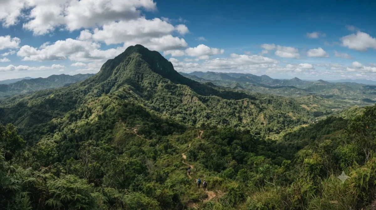
Mount Manunggal

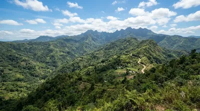
Mount Manunggal is the third-highest peak in the island of Cebu after Osmena Peak and Lugsangan Peak. It is located in Barangay Magsaysay in Balamban, Cebu province, rising 982 m (3,222 ft) above sea level. It is the site of the crash of the presidential plane Mt. Pinatubo that killed President Ramon Magsaysay and 24 others on March 17, 1957.

What it is

Mount Manunggal is the third-highest peak on Cebu island, reaching 982 m in Barangay Magsaysay, Balamban. Most visitors come for the historical connection: this is where the presidential plane crashed on March 17, 1957, killing President Ramon Magsaysay and 24 others. A marker and shrine at the site commemorate the event, and the mountain setting itself offers cooler air and views over Cebu's interior ranges.

Getting there

From Cebu City, the mountain is reached by heading inland toward Balamban, then following rough barangay roads up to Barangay Magsaysay. The drive typically takes around 1.5 to 2 hours depending on traffic through the city and road conditions higher up, which can be steep and unpaved in places. A private vehicle or a habal-habal (motorcycle taxi) for the final stretch is the practical option, as public transport doesn't run all the way to the summit area.

Time to allow

Plan for at least half a day once you factor in the travel time. At the site itself, an hour or two is usually enough to see the memorial marker, walk around the summit area, and take in the views before heading back down.

When to go

Go earlier in the day, since the road up can be harder to manage after rain and mist tends to roll in by afternoon. The rainy season (roughly June to November) can make the unpaved sections slippery, so dry months are more comfortable for the drive. It is not a heavily visited site day-to-day, though it can see more local visitors around the anniversary of the crash in March.

Combining with nearby sites

  • Central Cebu Protected Landscape (6.4 km) – close enough to pair with Mount Manunggal in the same outing.
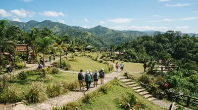
  • Kan-irag Nature Park (7.6 km) – another nearby nature stop for the same trip.
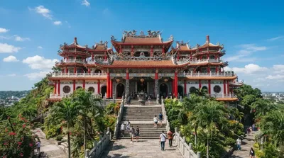
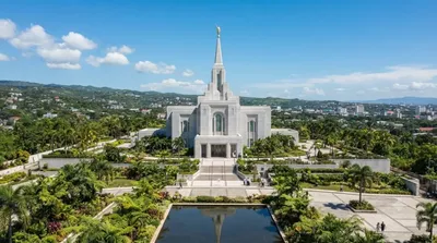
  • Cebu Taoist Temple (15.5 km) and Cebu City Philippines Temple (16.6 km) – further out, better suited to a separate day back in the city.

Quellen: offene Daten von Wikipedia und OpenStreetMap · Aktualisiert 5. August 2026 · Redaktion die World by City-Redaktion

Tickets & Touren

Eintrittspreise und Öffnungszeiten ändern sich häufig und stehen daher nicht hier. Unten sehen Sie, was gerade angeboten wird – vorab buchen spart mancherorts Wartezeit.

Dieser Ort erscheint womöglich nicht in den Ergebnissen – manche Ziele sind kostenlos oder verkaufen nur vor Ort.

Unterkünfte nahe Mount Manunggal

Nach Entfernung sortiert, fußläufige zuerst. Angaben als Luftlinie.

Karte © OpenStreetMap-Mitwirkende. Linien sind Luftlinien, keine echten Routen.

Mount Manunggal Unterkünfte in der Nähe

Lage und Namen stammen aus OpenStreetMap. Preise und Verfügbarkeit bitte auf den Buchungsseiten prüfen.

Passt gut dazu

Central-Cebu-Nationalpark

Natur

Central-Cebu-Nationalpark

Der Central-Cebu-Nationalpark liegt 18 km westlich von Cebu City, der Hauptstadt der Provinz Cebu, auf der Insel Cebu auf den Philippinen. Es wurde ursprünglich am 15. September 1937 auf einer Fläche von 153,93 km² mit Inkrafttreten der Proklamation 202 als Naturschutzgebiet eingerichtet. Am 27. März 1971 wurde er mit Inkrafttreten der Proklamation 835-A um seinen Schutzstatus auf einen Nationalpark erweitert, die Fläche jedoch auf 118,94 km² verkleinert. Seit 2007 ist er Teil des Naturparks Central Cebu Protected Landscape, der gemäß den Richtlinien des National Integrated Protected Areas Sys...

6.4 km entfernt

Kan-irag Nature Park

Parks & Gärten

Kan-irag Nature Park

The Kan-irag Nature Park is a watershed and nature park in the uplands of Cebu City, Philippines that opened in the mid-2000s. It was once a bald mountain, but due to reforestation with native trees, the area became a functioning watershed. It is home to about 27 native bird species, such as the emerald dove, Asian glossy starling, the collared kingfisher, the black-naped oriole, and the olive-backed sunbird. The park's size is 71 hectares.

7.6 km entfernt

Daoistischer Tempel in Cebu

Tempel & Sakralbauten

Daoistischer Tempel in Cebu

Der Taoist Temple in der Stadt Cebu City auf der Insel Cebu, Philippinen befindet sich im Stadtteil Beverly Hills, ca. 300 Meter über dem Meeresspiegel und ist über drei Zufahrtswege erreichbar.

15.5 km entfernt

Cebu City Philippines Temple

Tempel & Sakralbauten

Cebu City Philippines Temple

The Cebu City Philippines Temple is the 133rd operating temple of the Church of Jesus Christ of Latter-day Saints and the second constructed in the Philippines, following the one in Manila. The temple is located on Gorordo Avenue in Lahug, Cebu City, and serves church members in the Visayas and Mindanao regions.

16.6 km entfernt

SM J Mall

Shopping & Viertel

SM J Mall

SM J Mall, also known locally as J Mall, is a shopping mall in Mandaue, Philippines. Opened in 2011 and operated until 2023 as J Centre Mall, the mall was acquired by SM Prime Holdings and was temporarily closed for upgrades and renovations, reopening as SM J Mall on October 25, 2024. It is the first SM Supermall in Mandaue, the 4th SM Supermall in Cebu, and the 86th SM Supermall in the Philippines.

18.5 km entfernt

Matilda L. Bradford Memorial Church

Tempel & Sakralbauten

Matilda L. Bradford Memorial Church

Bradford Memorial Chapel, also known as Matilda Bradford Memorial Chapel, is a Protestant church located in Cebu City, Philippines. Built in 1913, it is the only Protestant church in Cebu declared as a national historical landmark by the National Historical Commission of the Philippines.

18.6 km entfernt