World by City

Shopping & Viertel

Pasir Ris
Pasir Ris

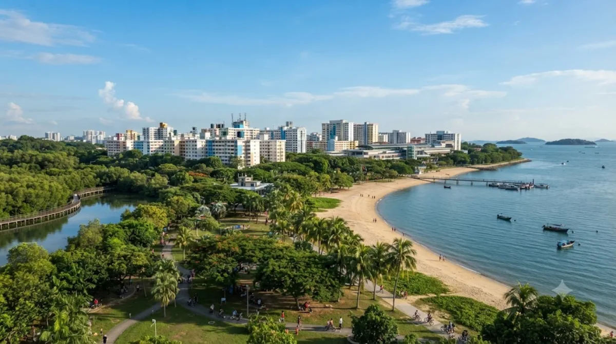
Pasir Ris ist ein Planungs- und Wohngebiet in der Ostregion von Singapur. Es grenzt im Süden an Tampines und Paya Lebar, im Südwesten an Sengkang und im Osten an Changi. Das Planungsgebiet teilt auch die Flussgrenze mit Punggol im Westen, getrennt durch den Serangoon River, sowie eine Seegrenze mit dem Planungsgebiet der Nordöstlichen Inseln über die Straße von Johor.

Pasir Ris

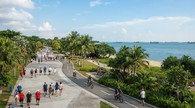
Pasir Ris is a residential planning area on the eastern coast of Singapore, best known to visitors for its stretch of park and beachfront along the Straits of Johor. It's a place to walk or cycle along the coast, look out toward Pulau Ubin and the Johor coastline, and see a quieter, more local side of Singapore away from the downtown core. The area also has one of the last remaining mangrove patches on the main island, reachable via boardwalks in the park.

Getting there

Pasir Ris sits at the eastern end of the MRT East-West Line, about 30-40 minutes by train from the city centre (around the Orchard or City Hall area). By taxi or ride-hail, expect roughly 25-35 minutes depending on traffic.

How much time to allow

A couple of hours is enough for a walk through the park and along the beach. If you plan to cycle further or explore the mangrove boardwalk in more depth, allow half a day.

When to go

Mornings and late afternoons are more comfortable, since the area is exposed and can feel hot at midday. Weekends bring more local families and picnickers to the park, so weekday visits are quieter.

Combining with other sights

Pasir Ris is fairly separate from Singapore's other major attractions, so it works best as its own outing rather than paired with sights closer to the city. The nearest listed attraction, East Coast Park, is about 7.9km away and offers a similar coastal park experience if you want to compare the two. Sights further west, such as Kallang River, Sri Srinivasa Perumal Temple, and Masjid Hajjah Fatimah, are all over 11km away and better treated as separate trips.

Quellen: offene Daten von Wikipedia und OpenStreetMap · Aktualisiert 5. August 2026 · Redaktion die World by City-Redaktion

Tickets & Touren

Eintrittspreise und Öffnungszeiten ändern sich häufig und stehen daher nicht hier. Unten sehen Sie, was gerade angeboten wird – vorab buchen spart mancherorts Wartezeit.

Dieser Ort erscheint womöglich nicht in den Ergebnissen – manche Ziele sind kostenlos oder verkaufen nur vor Ort.

Unterkünfte nahe Pasir Ris

Nach Entfernung sortiert, fußläufige zuerst. Angaben als Luftlinie.

Karte © OpenStreetMap-Mitwirkende. Linien sind Luftlinien, keine echten Routen.

Pasir Ris Unterkünfte in der Nähe

Lage und Namen stammen aus OpenStreetMap. Preise und Verfügbarkeit bitte auf den Buchungsseiten prüfen.

Passt gut dazu

East Coast Park

Parks & Gärten

East Coast Park

East Coast Park (ECP) is a beach and a park on the southeastern coast of Singapore. It stretches along the south of Marine Parade, Bedok, and Tampines. It was opened in the 1970s, after the Singapore government had completed reclaiming land off the coast at Katong, from Kallang to Changi. Themed "Recreation for All", it not only serves the needs of communities in the east, other Singapore residents do also visit the park for sports, recreation, and food.

7.9 km entfernt

Kallang River

Natur

Kallang River

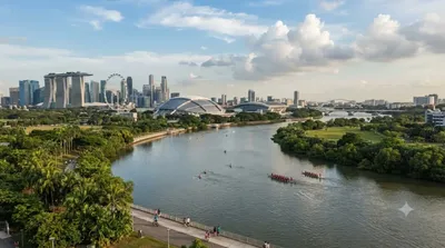
The Kallang River is the longest river in Singapore, flowing for 10 kilometers from the Lower Peirce Reservoir to the Kallang Basin. It originates in the planning area of Central Water Catchment, flows in a southeast direction through Bishan and Toa Payoh, before finally arriving in Kallang.

11.7 km entfernt

Sri Srinivasa Perumal Temple, Singapore

Tempel & Sakralbauten

Sri Srinivasa Perumal Temple, Singapore

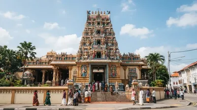
Sri Srinivasa Perumal Temple or Sri Perumal Temple is one of the oldest temples in Singapore. It is located in Little India within the planning area of Kallang along Serangoon Road, where its tall Gopuram (tower) shows the different incarnations of Lord Vishnu. This large complex, dedicated to Vishnu, dates from 1855, but the 20-metres-tall Gopuram was only built in 1966 at a cost of S$300,000. The temple's five-tier Gopuram was a donation from P. Govindasamy Pillai, one of the earliest Indian migrants to Singapore. In 1978, the temple was gazetted as a National monument of Singapore.

12.1 km entfernt

Masjid Hajjah Fatimah

Tempel & Sakralbauten

Masjid Hajjah Fatimah

Masjid Hajjah Fatimah is a mosque located along Beach Road in Kampong Glam, Singapore. It is named for its founder, Fatimah binti Sulaiman, who is buried in the same place along with her family and descendants. The mosque is recognizable and well-known for its eclectic architecture, such as its unique minaret and golden onion dome, while it has also been gazetted as a national monument of Singapore.

12.1 km entfernt

Masjid Malabar

Tempel & Sakralbauten

Masjid Malabar

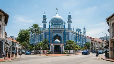
Masjid Malabar or Malabar Muslim Jama'ath Mosque, also known as Golden Dome Mosque or alternatively the Blue Mosque, is a historic mosque located at the junction of Victoria Street and Jalan Sultan in the Kampong Glam district within the Rochor Planning Area in Singapore. First built in 1819 on a site of an older mosque and recognizable for its blue lapis lazuli tiled exterior and three golden domes, it is the only mosque in the country that caters to Malabar Muslims. Due to its similarities in architecture, especially with the golden onion domes, the mosque has been nicknamed as the "cousin"...

12.2 km entfernt

Masjid Sultan

Tempel & Sakralbauten

Masjid Sultan

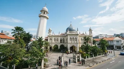
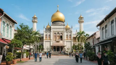
Die Masjid Sultan (Sultan-Moschee) befindet sich zwischen der Muscat Street und North Bridge Road im Kampong-Glam-Distrikt in Singapur. Die 1928 eröffnete Moschee gilt als eine der wichtigsten Moscheen Singapurs.

12.5 km entfernt