World by City

Natur

Kallang River

Kallang River

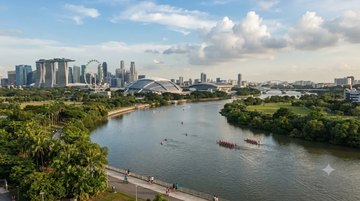
The Kallang River is the longest river in Singapore, flowing for 10 kilometers from the Lower Peirce Reservoir to the Kallang Basin. It originates in the planning area of Central Water Catchment, flows in a southeast direction through Bishan and Toa Payoh, before finally arriving in Kallang.

What it is

The Kallang River is Singapore's longest river, running about 10 kilometres from the Lower Peirce Reservoir down to the Kallang Basin, cutting through Bishan and Toa Payoh before reaching the sea at Kallang. Much of its course has been reworked into a landscaped park corridor with cycling and walking paths, so it's less a river you visit for a single site and more a green route you follow — good for a walk, a run, or a stretch of cycling away from traffic.

Getting there

Access depends on which stretch you want: the Kallang Basin end near the river mouth is easiest to reach from the city centre, roughly 10-15 minutes by taxi or MRT plus a short walk. The upstream sections through Bishan and Toa Payoh are best reached via the MRT stations in those towns, also around 15-20 minutes from downtown.

Time to allow

An hour or two is enough for a walk along one section of the riverside park. If you're cycling a longer stretch, allow half a day.

When to go

Early morning or late afternoon is more comfortable, avoiding the midday heat and humidity. Weekends tend to draw more joggers, cyclists, and families to the park sections, so weekday visits are quieter.

Combine with

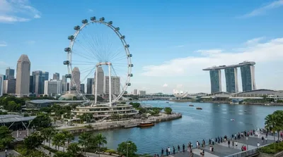
  • If you're near the Kallang Basin end, the Singapore Flyer is about 1.5km away.
  • Masjid Hajjah Fatimah (0.8km) and Masjid Sultan (1.2km) make a reasonable pairing if you're exploring the Kampong Glam area nearby.
  • Masjid Malabar, also around 1.2km away, can be folded into the same walk through the historic mosque district.

Quellen: offene Daten von Wikipedia und OpenStreetMap · Aktualisiert 5. August 2026 · Redaktion die World by City-Redaktion

Tickets & Touren

Eintrittspreise und Öffnungszeiten ändern sich häufig und stehen daher nicht hier. Unten sehen Sie, was gerade angeboten wird – vorab buchen spart mancherorts Wartezeit.

Dieser Ort erscheint womöglich nicht in den Ergebnissen – manche Ziele sind kostenlos oder verkaufen nur vor Ort.

Unterkünfte nahe Kallang River

Nach Entfernung sortiert, fußläufige zuerst. Angaben als Luftlinie.

Karte © OpenStreetMap-Mitwirkende. Linien sind Luftlinien, keine echten Routen.

Kallang River Unterkünfte in der Nähe

Lage und Namen stammen aus OpenStreetMap. Preise und Verfügbarkeit bitte auf den Buchungsseiten prüfen.

Passt gut dazu

Masjid Hajjah Fatimah

Tempel & Sakralbauten

Masjid Hajjah Fatimah

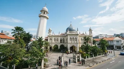
Masjid Hajjah Fatimah is a mosque located along Beach Road in Kampong Glam, Singapore. It is named for its founder, Fatimah binti Sulaiman, who is buried in the same place along with her family and descendants. The mosque is recognizable and well-known for its eclectic architecture, such as its unique minaret and golden onion dome, while it has also been gazetted as a national monument of Singapore.

0.8 km entfernt

Masjid Sultan

Tempel & Sakralbauten

Masjid Sultan

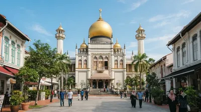
Die Masjid Sultan (Sultan-Moschee) befindet sich zwischen der Muscat Street und North Bridge Road im Kampong-Glam-Distrikt in Singapur. Die 1928 eröffnete Moschee gilt als eine der wichtigsten Moscheen Singapurs.

1.2 km entfernt

Masjid Malabar

Tempel & Sakralbauten

Masjid Malabar

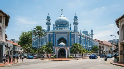
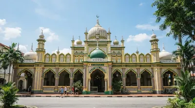
Masjid Malabar or Malabar Muslim Jama'ath Mosque, also known as Golden Dome Mosque or alternatively the Blue Mosque, is a historic mosque located at the junction of Victoria Street and Jalan Sultan in the Kampong Glam district within the Rochor Planning Area in Singapore. First built in 1819 on a site of an older mosque and recognizable for its blue lapis lazuli tiled exterior and three golden domes, it is the only mosque in the country that caters to Malabar Muslims. Due to its similarities in architecture, especially with the golden onion domes, the mosque has been nicknamed as the "cousin"...

1.2 km entfernt

Singapore Flyer

Aussicht & Wahrzeichen

Singapore Flyer

Der Singapore Flyer ist mit einer Höhe von 165 Metern das dritthöchste Riesenrad der Welt, von März 2008 bis April 2014 war es das weltweit höchste. Es steht in einer ufernahen Grünanlage am Rande der Stadt im Stadtstaat Singapur und löste bei seiner Eröffnung den Stern von Nanchang als größtes Riesenrad der Welt ab.

1.5 km entfernt

Helix-Brücke

Aussicht & Wahrzeichen

Helix-Brücke

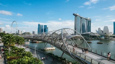
Die Helix-Brücke ist eine Fußgängerbrücke, die das Marina Centre mit Marina South innerhalb Marina Bay von Singapur verbindet. Sie überquert den Marina Channel, der sich kurz nach der Mündung des Singapore River in die Marina Bay an der Grenze der Planungsgebiete Downtown Core und Marina East befindet. Offiziell wurde die Brücke am 24. April 2010 eröffnet, de facto schon teilweise zuvor im Zuge der Bauarbeiten von Marina Bay Sands. Die Brücke befindet sich neben der Benjamin Sheares Bridge. Sie besteht – neben der genannten „Helix-Brücke“ für Fußgänger – aus einer parallel verlaufenden Fahrzeu...

1.8 km entfernt

Masjid Abdul Gaffoor

Tempel & Sakralbauten

Masjid Abdul Gaffoor

Masjid Abdul Gaffoor and occasionally known as the Dunlop Street Mosque, is a historic mosque located in Little India, Singapore. Named after its founder Shaik Abdul Gaffoor, it was originally built in 1910 as a replacement of an older mosque located along Dunlop Street. It was gazetted as a national monument of Singapore in 1979.

1.8 km entfernt