Aussicht & Wahrzeichen
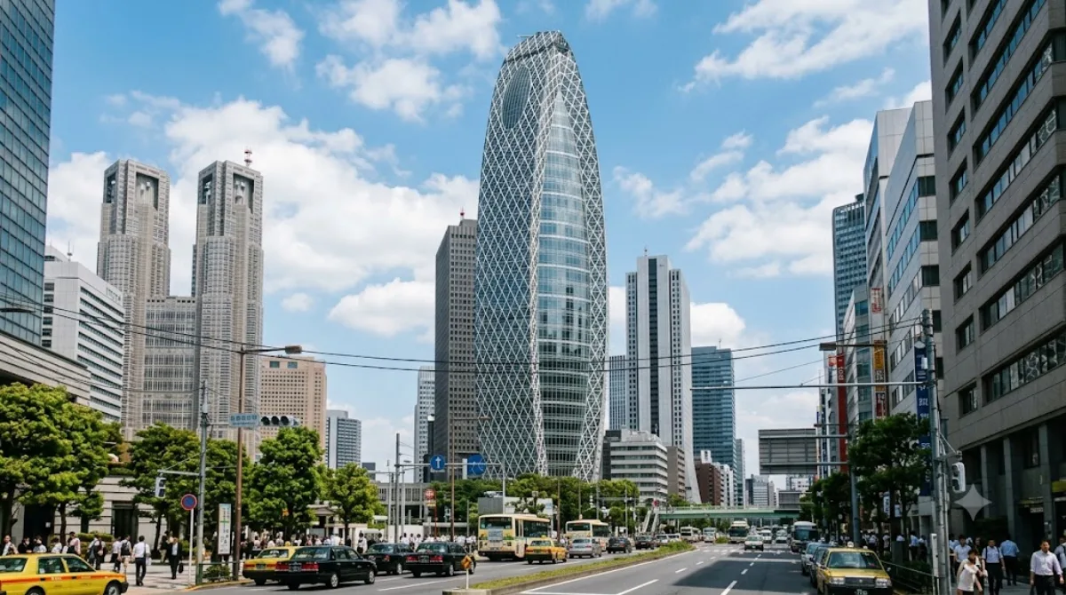
Mode Gakuen Cocoon Tower
Mode Gakuen Cocoon Tower
Bei diesem 204 Meter hohen Gebäude in Nishi-Shinjuku handelt es sich um eine Bildungseinrichtung, in der Berufsschulen für Mode, Medizin und IT untergebracht sind. Da es sich um ein aktives Schulgebäude handelt, ist der Turm primär ein architektonisches Wahrzeichen. Besucher kommen hierher, um die markante, kokonförmige Fassade aus der Straßenperspektive zu betrachten und zu fotografieren.
Anreise und Zeitplanung
Der Turm befindet sich im westlichen Wolkenkratzer-Distrikt von Shinjuku. Vom Stadtzentrum aus ist er in etwa 10 bis 20 Minuten mit dem öffentlichen Nahverkehr oder zu Fuß erreichbar, je nach Startpunkt innerhalb des Viertels.
Da die Attraktion hauptsächlich aus der Außenansicht besteht, reicht ein Zeitaufwand von 15 bis 30 Minuten aus, um das Gebäude zu besichtigen und Fotos zu machen.
Beste Besuchszeit
Das Gebäude kann zu jeder Tageszeit betrachtet werden. Besonders empfehlenswert ist der Besuch in den Abendstunden, wenn die Fassade beleuchtet ist. Es gibt keine saisonalen Einschränkungen, da die Besichtigung im Freien stattfindet. In den belebten Straßen von Shinjuku kann es je nach Tageszeit stark frequentiert sein.
Kombinationsmöglichkeiten
Aufgrund der zentralen Lage lässt sich der Besuch mit anderen Sehenswürdigkeiten in der Umgebung verbinden:
- Kabukichō (0,7 km)
- NTT Docomo Yoyogi Building (1 km)
- Shinjuku Gyoen (1,3 km)
- Meiji Jingū (1,7 km)
Aktualisiert 20. September 2026 · Redaktion die World by City-Redaktion
 GetYourGuide
 Klook
Klook
 Tiqets
 KKday
KKday
 WeGoTrip
 Booking.com
 Hotels.com