World by City

寺社・宗教施設

難波八阪神社

Namba-yasaka Shrine
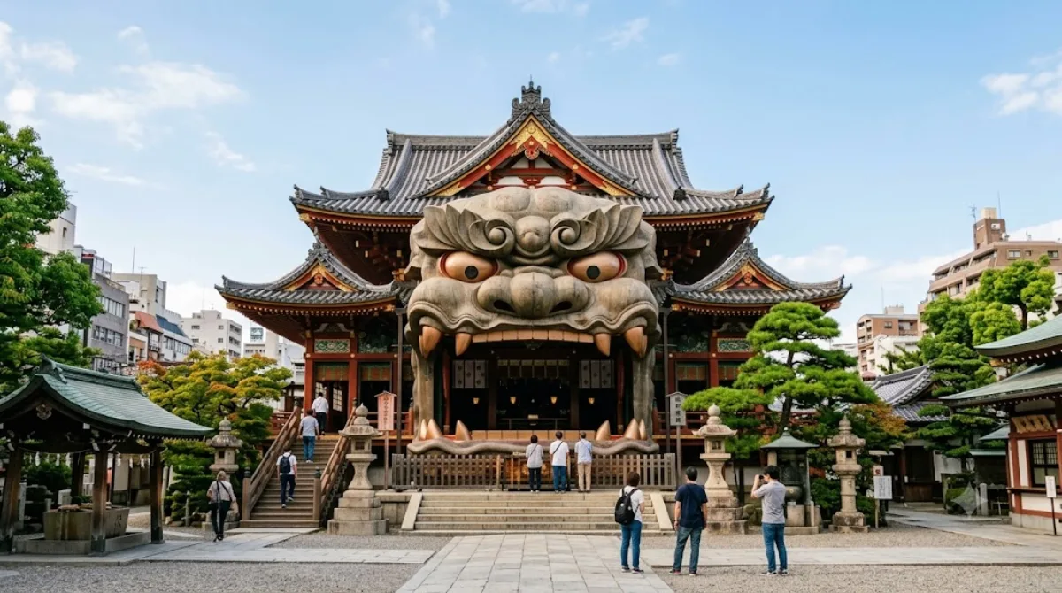
難波八阪神社

難波八阪神社(なんばやさかじんじゃ)は、大阪市浪速区にある神社。旧社格は郷社。よく「難波八坂神社」と書かれているが、これは誤字である。

Namba-yasaka Shrine

Namba-yasaka Shrine is a Shinto shrine best known for a large stage-like structure shaped like a lion's head, built over the main altar. The lion-head hall is the reason most visitors stop by — it's an unusual piece of shrine architecture and a popular photo spot, distinct from the more conventional wooden halls found at most city shrines. Beyond that structure, the grounds are compact and can be seen as a quiet detour from the surrounding entertainment district.

Getting there

The shrine sits close to Namba, about a 10-15 minute walk from Namba Station and the wider Dōtonbori area. It's a small enough distance that a taxi isn't really necessary; walking is the simplest option from central Osaka.

How long to stay

Most visitors spend 15-30 minutes here, mainly to see and photograph the lion-head stage and take a short walk around the grounds. It's not a place that requires a long visit.

When to go

Mornings or early afternoon tend to be calmer, since the shrine's small size means even moderate visitor numbers can make the area around the lion-head stage feel crowded, especially when tour groups stop for photos. Weekends can be busier than weekdays.

Combine it with

Its location makes it easy to fold into a walk through central Osaka:

  • Namba (0.7km) – the closest major hub, with train connections and shopping
  • Dōtonbori (0.9km) – the canal-side dining and neon-sign district
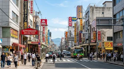
  • Nipponbashi (1.2km) – known for electronics and anime/manga shops
  • Shinsaibashi (1.3km) – a major shopping street

Given the short distances, the shrine works well as a brief stop on a longer walk between Namba and Dōtonbori rather than a standalone destination.

出典:ウィキペディア・OpenStreetMap の公開データ · 2026年8月5日 更新 · 編集 World by City 編集部

チケット・ツアー予約

入場料や営業時間は変わりやすいためここには載せていません。下で現在販売中のチケットと価格をご確認ください。事前購入で待ち時間を減らせる場所もあります。

検索結果にこの場所のチケットがない場合もあります。入場無料、または現地販売のみの施設もあります。

難波八阪神社 周辺の宿

歩いて行ける距離から近い順に並べています。距離は直線距離です。

地図 © OpenStreetMap 寄稿者。直線でつないでいるため実際の経路とは異なります。

難波八阪神社 周辺の宿

宿の位置と名称は OpenStreetMap のデータに基づきます。価格と空室は各予約サイトでご確認ください。

あわせて訪れたい場所

難波

ショッピング・繁華街

難波

難波(なんば)は、大阪府大阪市中央区・浪速区に広がる大阪を代表する繁華街の一つ。または、中央区の町名。現行行政地名は難波一丁目から難波五丁目まで。

ここから 0.7 km

道頓堀

ショッピング・繁華街

道頓堀

道頓堀(どうとんぼり)は、大阪府大阪市中央区の繁華街および町名。または、同所の北を流れる道頓堀川の略称。町名は道頓堀一丁目と道頓堀二丁目があり、一丁目の堺筋以東は街区符号に「東」が付き、郵便番号も異なる。隣接する難波や千日前などとともにミナミの繁華街の中心的地区である。

ここから 0.9 km

日本橋

展望・ランドマーク

日本橋

日本橋(にっぽんばし)は、大阪府大阪市中央区・浪速区の町名および周辺の地域名。または道頓堀川に架かる堺筋の橋。現行行政地名は日本橋一丁目から日本橋五丁目。日本橋一丁目および日本橋二丁目が中央区、日本橋三丁目から日本橋五丁目が浪速区に属する。

ここから 1.2 km

心斎橋

ショッピング・繁華街

心斎橋

心斎橋(しんさいばし)は、大阪府大阪市中央区の大阪を代表する繁華街。また、かつて長堀川に架かっていた橋でのちに長堀通に整備された歩道橋。範囲としては心斎橋筋・西心斎橋・東心斎橋の辺りであり、行政上「心斎橋」という地名は存在しない。

ここから 1.3 km

新世界

ショッピング・繁華街

新世界

新世界 は、大阪府大阪市浪速区恵美須東に位置する繁華街。中央やや北寄りに通天閣が建ち、南東部にジャンジャン横丁がある。

ここから 1.3 km

通天閣

展望・ランドマーク

通天閣

通天閣 は、大阪府大阪市浪速区の新世界に所在するNANKAIグループの展望塔。現在の通天閣は2代目で、1912年に初代通天閣が誕生した後、1956年に現行の塔が建造されている。2007年5月15日に登録有形文化財となった。公式キャラクターは「ビリケン」。大阪・新世界の観光名所ならびにランドマークとして知られる。

ここから 1.3 km