World by City

寺社・宗教施設

スルタンモスク

Masjid Sultan
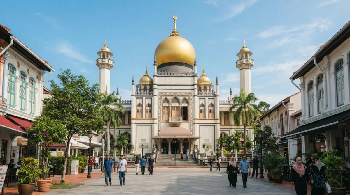
スルタンモスク

술탄 모스크(Masjid Sultan)는 싱가포르 캄퐁 글램의 무스캣가와 노스브리지길에 위치한 사원이다. 1975년 국가 기념물로 지정되었다.

Sultan Mosque

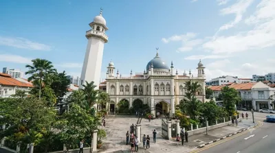
Sultan Mosque is the best-known mosque in Singapore and a national monument, standing at the heart of Kampong Glam. Its golden domes and the current building, completed in 1932, replaced an earlier 1826 mosque and are named for Sultan Hussein Shah of Johor, one of the figures involved in Singapore's founding. It remains an active place of worship, so it's worth visiting as much for the surrounding Kampong Glam streets - Arab Street's textile shops, cafes and murals - as for the building itself.

Getting there

From the city centre (the Marina Bay / Orchard Road area), it's around a 15-20 minute taxi or rideshare ride depending on traffic. By public transport, take the MRT to Bugis station and walk about 10 minutes through Kampong Glam, or to Nicoll Highway station for a similar walk from the other direction.

How much time to allow

Seeing the mosque exterior and courtyard takes 15-20 minutes. Most travellers spend an hour or two in the area overall, combining the mosque with a walk through the surrounding lanes and shops.

When to go

As an active mosque, it can be busy around prayer times, particularly on Fridays. Visitors should dress modestly, and non-worshippers should expect areas to be off-limits or quieter during prayers. Mornings and weekday afternoons tend to be calmer for photos of the exterior.

Combine with

Several other mosques sit within easy walking distance: Masjid Malabar (0.4km), known for its blue-tiled facade, Masjid Hajjah Fatimah (0.5km), and Masjid Abdul Gaffoor (0.6km), notable for its sundial motif. Little India is about 1km away and can be combined into a longer walking route covering both ethnic districts.

出典:ウィキペディア・OpenStreetMap の公開データ · 2026年8月5日 更新 · 編集 World by City 編集部

チケット・ツアー予約

入場料や営業時間は変わりやすいためここには載せていません。下で現在販売中のチケットと価格をご確認ください。事前購入で待ち時間を減らせる場所もあります。

検索結果にこの場所のチケットがない場合もあります。入場無料、または現地販売のみの施設もあります。

スルタンモスク 周辺の宿

歩いて行ける距離から近い順に並べています。距離は直線距離です。

地図 © OpenStreetMap 寄稿者。直線でつないでいるため実際の経路とは異なります。

スルタンモスク 周辺の宿

宿の位置と名称は OpenStreetMap のデータに基づきます。価格と空室は各予約サイトでご確認ください。

あわせて訪れたい場所

Masjid Malabar

寺社・宗教施設

Masjid Malabar

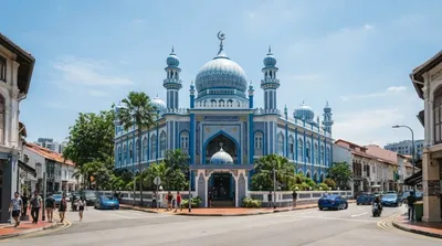
Masjid Malabar or Malabar Muslim Jama'ath Mosque, also known as Golden Dome Mosque or alternatively the Blue Mosque, is a historic mosque located at the junction of Victoria Street and Jalan Sultan in the Kampong Glam district within the Rochor Planning Area in Singapore. First built in 1819 on a site of an older mosque and recognizable for its blue lapis lazuli tiled exterior and three golden domes, it is the only mosque in the country that caters to Malabar Muslims. Due to its similarities in architecture, especially with the golden onion domes, the mosque has been nicknamed as the "cousin"...

ここから 0.4 km

Masjid Hajjah Fatimah

寺社・宗教施設

Masjid Hajjah Fatimah

Masjid Hajjah Fatimah is a mosque located along Beach Road in Kampong Glam, Singapore. It is named for its founder, Fatimah binti Sulaiman, who is buried in the same place along with her family and descendants. The mosque is recognizable and well-known for its eclectic architecture, such as its unique minaret and golden onion dome, while it has also been gazetted as a national monument of Singapore.

ここから 0.5 km

Masjid Abdul Gaffoor

寺社・宗教施設

Masjid Abdul Gaffoor

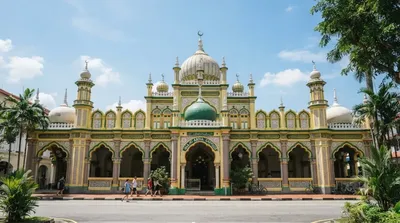
Masjid Abdul Gaffoor and occasionally known as the Dunlop Street Mosque, is a historic mosque located in Little India, Singapore. Named after its founder Shaik Abdul Gaffoor, it was originally built in 1910 as a replacement of an older mosque located along Dunlop Street. It was gazetted as a national monument of Singapore in 1979.

ここから 0.6 km

リトル・インディア

ショッピング・繁華街

リトル・インディア

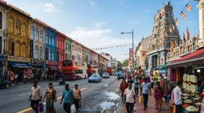
リトル・インディア は、シンガポールのシンガポール川の東、ロコール運河の北側に位置する、セラングーン・ロードを中心とした、インド系のシンガポール人の居住地域である。

ここから 1.0 km

シンガポール美術館

博物館・美術館

シンガポール美術館

싱가포르 미술관(Singapore Art Museum)은 싱가포르에 위치한 미술관이다.

ここから 1.0 km

Kallang River

自然

Kallang River

The Kallang River is the longest river in Singapore, flowing for 10 kilometers from the Lower Peirce Reservoir to the Kallang Basin. It originates in the planning area of Central Water Catchment, flows in a southeast direction through Bishan and Toa Payoh, before finally arriving in Kallang.

ここから 1.2 km