World by City

展望・ランドマーク

台北大橋

Taipei Bridge
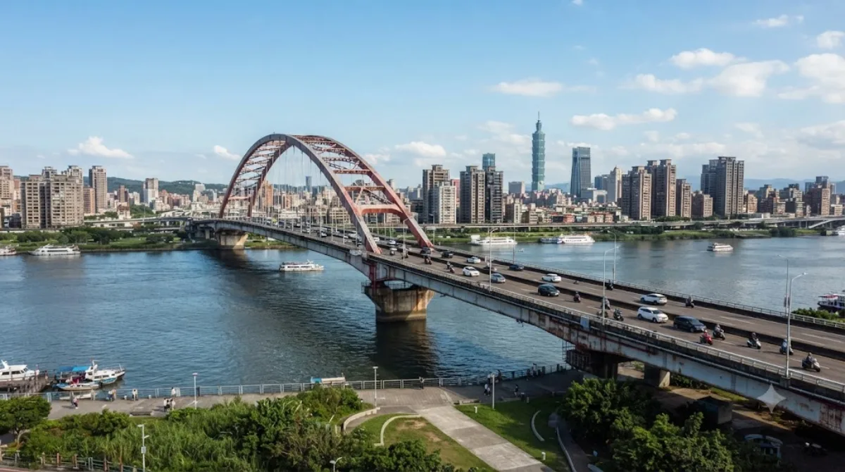
台北大橋

台北大橋(たいぺいおおはし)または台北橋(たいぺいきょう)は、中華民国台北市大同区と新北市三重区の境を流れる淡水河に架かる台湾省道台1線の道路橋である。1991年に改修され1996年に現在の姿となっているが、その源流は清朝統治時代の鉄道橋(淡水橋)にまで遡る。その後の台北橋、淡水橋、大橋頭、日本統治時代の大橋町などの地名の由来となっている。

What it is

Taipei Bridge carries road traffic across the Tamsui River, linking Taipei's Datong District with Sanchong District in New Taipei City. The main span runs 481.6 metres and handles cars and some motorcycles, while narrower side spans carry the bulk of the motorcycle traffic along with cyclists and pedestrians. There's no observation deck or ticketed viewpoint here — it's a working bridge, and the appeal for a visitor is walking or cycling across it for open river views and a look at the city's daily traffic flow, rather than any landmark architecture.

Getting there

The bridge sits on the Taipei side near the older Dadaocheng and Datong neighbourhoods, a short taxi or bus ride from the city centre — figure roughly 20-30 minutes depending on traffic. It's also reachable on foot or by bike along the riverside paths that run beside the Tamsui River.

Time to allow

Walking across and back takes about 30-45 minutes if you're just there for the views. Cyclists passing through as part of a longer riverside ride won't need to stop for more than a few minutes.

When to go

Traffic on the central span is heavy with cars and scooters during morning and evening commute hours, which makes those times noisier and less pleasant for walking. Early morning or late afternoon on the pedestrian side spans tends to be calmer, and the riverside setting is more comfortable outside the hottest midday hours in summer.

Combine it with

The bridge is close to several of Taipei's older cultural sites: Immaculate Conception Cathedral and the Ama Museum are both about 1.2km away, Taipei Confucian Temple is around 1.5km, and Huguo Chan Buddhist Temple of the Linji School is about 1.8km. These can be strung together into a single walking loop through the historic Dadaocheng area before or after crossing the bridge.

出典:ウィキペディア・OpenStreetMap の公開データ · 2026年8月5日 更新 · 編集 World by City 編集部

チケット・ツアー予約

入場料や営業時間は変わりやすいためここには載せていません。下で現在販売中のチケットと価格をご確認ください。事前購入で待ち時間を減らせる場所もあります。

検索結果にこの場所のチケットがない場合もあります。入場無料、または現地販売のみの施設もあります。

台北大橋 周辺の宿

歩いて行ける距離から近い順に並べています。距離は直線距離です。

地図 © OpenStreetMap 寄稿者。直線でつないでいるため実際の経路とは異なります。

台北大橋 周辺の宿

宿の位置と名称は OpenStreetMap のデータに基づきます。価格と空室は各予約サイトでご確認ください。

あわせて訪れたい場所

聖母無原罪司教座堂 (台北市)

寺社・宗教施設

聖母無原罪司教座堂 (台北市)

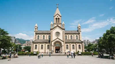
聖母無原罪司教座堂(せいぼむげんざいしきょうざどう)は台湾 台北市大同区民生西路245号にあるキリスト教 カトリック台北教区の司教座聖堂 である。敷地内には幼稚園が併設され、カトリック系の静修女子中学も隣接している。

ここから 1.2 km

阿マの家 平和と女性人権館

博物館・美術館

阿マの家 平和と女性人権館

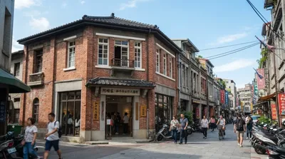
阿マの家 平和と女性人権館 は、台湾台北市大同区にある慰安婦記念館。開館当初は同区一段256号にあったが、2021年からは同区承德路三段32号5階に移転した。

ここから 1.2 km

台北孔子廟

寺社・宗教施設

台北孔子廟

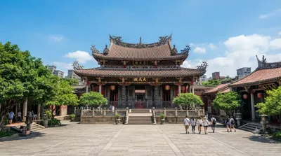
台北孔子廟(たいぺいこうしびょう)または台北市孔廟は、台北市大同区大龍街にある孔子廟。台南孔子廟と並ぶ台湾の代表的な孔子廟。

ここから 1.5 km

臨済護国禅寺

寺社・宗教施設

臨済護国禅寺

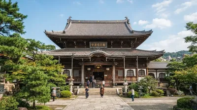
臨済護国禅寺(りんざいごこくぜんじ)は、台湾の台北市中山区の旧円山町に位置する臨済宗妙心寺派の寺で、台北市の「市指定古蹟」に指定されている。

ここから 1.8 km

台北ツインズ

展望・ランドマーク

台北ツインズ

타이베이 트윈 타워(중국어: 臺北雙星, 영어: Taipei Twins)는 타이완 타이베이시에 제안된 마천루이다. 공사기간은 6년 9개월인데 만약 2027년 12월 31일 완공된다라고 가정하면 늦어도 2021년 3월 31일에는 착공했어야 하지만 현재까지 아무런 정보도 없는 상태이다. 2022년 11월 11일에 드디어 착공하였다.

ここから 1.8 km

台北当代芸術館

博物館・美術館

台北当代芸術館

台北当代芸術館 は台北市大同区にある現代美術の美術館。かつての日本統治時代に建てられた建築を利用しており、台北市政府旧廈として台北市の市定古蹟に認定されている。

ここから 1.9 km