World by City

自然

お台場

Odaiba

お台場

오다이바(일본어: お台 場 )는 일본 도쿄도 미나토구 다이바에 있는 지역이다. 다이바 1정목부터 다이바 2정목으로 구성되어 있다. 미나토 구의 인구조사에 의하면 지역 인구는 2008년 4월 1일 기준 5,172명이다. 다이바를 나타내는 우편번호는 135-0091이다. 넓게는 시나가와구 히가시야시오, 고토구 아오미를 아울러는 지역도 포함하여 오다이바라고 부르기도 한다. 이 지역은 도쿄 임해부도심의 일부이다. 도쿄의 주요 관광지역 중의 하나로 많은 유락시설이 있으며, 매해 관광객들로 붐비는 곳이기도 하다.

Odaiba

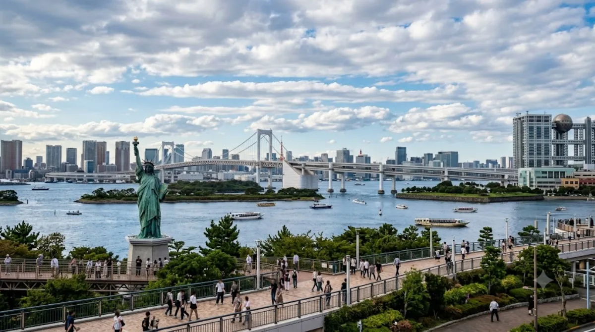
Odaiba is a large reclaimed island in Tokyo Bay, connected to the mainland by the Rainbow Bridge. It began as a set of defensive fort islands in the 1850s before being expanded and redeveloped into a mixed commercial, residential and leisure district. Its main draw for visitors is the waterfront itself: a stretch of open bay shoreline with views back toward central Tokyo, which is unusual for a harbor city where much of the water's edge is taken up by port and industrial land.

Getting there

The easiest access is by the Yurikamome elevated train from Shimbashi, which crosses the Rainbow Bridge and gives you an elevated view of the bay on the way in; the ride takes around 15-20 minutes. The Rinkai Line, reachable from Osaki or Shinjuku, is a faster underground alternative to Tokyo Teleport Station. Water buses from spots like Asakusa or Hinode Pier are a slower but more scenic option.

How much time to allow

A half day is enough to walk the waterfront and see one or two attractions on the island. A full day makes sense if you want to add a museum visit or linger over the shoreline and shopping malls.

When to go

Evening is a good time to be on the waterfront, since the Rainbow Bridge and the Tokyo skyline are lit up after dark. Weekends and holidays draw larger crowds, particularly around the malls and the beach promenade, so weekday visits are calmer.

Combine it with

  • Miraikan (1.2km) is close enough to pair with a waterfront walk in the same visit.
  • Hamarikyu Gardens (3.5km) and Shiodome (3.9km) are a short trip back across the bay toward central Tokyo.
  • Tokyo Tower (4.1km) can be added if you're continuing on toward Minato after Odaiba.

出典:ウィキペディア・OpenStreetMap の公開データ · 2026年8月5日 更新 · 編集 World by City 編集部

チケット・ツアー予約

入場料や営業時間は変わりやすいためここには載せていません。下で現在販売中のチケットと価格をご確認ください。事前購入で待ち時間を減らせる場所もあります。

検索結果にこの場所のチケットがない場合もあります。入場無料、または現地販売のみの施設もあります。

お台場 周辺の宿

歩いて行ける距離から近い順に並べています。距離は直線距離です。

地図 © OpenStreetMap 寄稿者。直線でつないでいるため実際の経路とは異なります。

お台場 周辺の宿

宿の位置と名称は OpenStreetMap のデータに基づきます。価格と空室は各予約サイトでご確認ください。

あわせて訪れたい場所

日本科学未来館

博物館・美術館

日本科学未来館

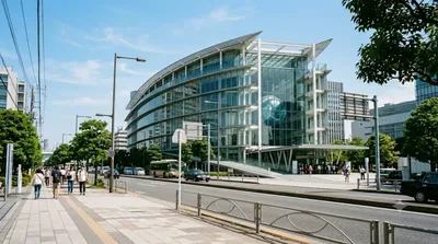
일본 과학 미래관(일본어: 日本科学未来館 닛폰카가쿠미라이칸[*], 영어: National Museum of Emerging Science and Innovation)은 일본 도쿄도 고토구 아오미 국제 연구 교류 대학촌에 있는 과학관이다. 애칭은 미라이칸(일본어: みらいCAN, 영어: Miraikan)이다.

ここから 1.2 km

浜離宮恩賜庭園

城・宮殿

浜離宮恩賜庭園

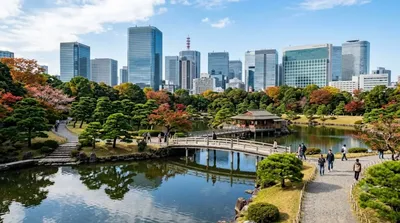
浜離宮恩賜庭園 は、東京都中央区浜離宮庭園にある潮入の池と二つの鴨場をもつ都立庭園である。旧浜離宮庭園 として特別史跡・特別名勝に指定されている。

ここから 3.5 km

汐留

ショッピング・繁華街

汐留

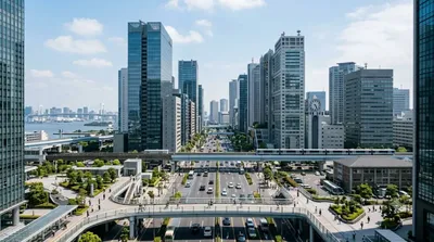
汐留(しおどめ)は、東京都港区の地区名・旧町名。現在ではおもに、新橋駅東側の汐留地区に建設された巨大複合都市“汐留シオサイト(siosite)”を指す。 かつての汐留(汐留町)は、現行行政地名では、東新橋の大部分と、海岸一丁目の一部にあたる。

ここから 3.9 km

東京タワー

展望・ランドマーク

東京タワー

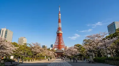
도쿄 타워(일본어: 東京タワー 도쿄타와[*], 영어: Tokyo Tower)는 일본 도쿄도 미나토구에 있는 높이 333m의 종합 전파탑으로, 관광명소로서의 인기는 지금도 여전하다(에펠탑을 모방해서 만들었음).

ここから 4.1 km

銀座

ショッピング・繁華街

銀座

銀座(ぎんざ)は、東京都中央区の地名で、日本を代表する繁華街である。旧・京橋区の地域にある。現行行政地名は銀座一丁目から銀座八丁目。住居表示実施済区域。 ブランドショップなどが立ち並ぶ高級商業地であり、地域ブランドとしても知られている。都心随一の規模を誇る繁華街であり、新宿・渋谷・池袋などとともに東京を代表する商業地である。繁華街売上高が日本一である。

ここから 4.7 km

六本木

ショッピング・繁華街

六本木

六本木(ろっぽんぎ)は、東京都港区の町名。現行行政区画は六本木一丁目から六本木七丁目。住居表示実施済区域。

ここから 5.4 km