World by City

자연

비사야 제도

Visayas

비사야 제도

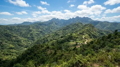
비사야 제도(타갈로그어: Kabisayaan, 영어: Visayas / Visayan Islands)는 필리핀을 구성하는 세 지역 중 하나로, 루손섬과 민다나오섬 사이에 위치하며, 큰 섬 7개와 수백 개의 작은 섬들로 이루어져 있다. 주요 도시로 세부가 있다.

비사야 제도, 세부에서 만나는 필리핀 중부의 바다

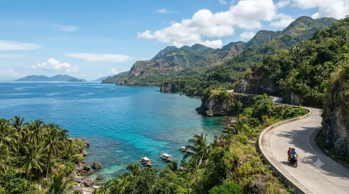
비사야는 루손, 민다나오와 함께 필리핀을 이루는 3대 지역 중 하나로, 세부를 포함한 여러 섬이 비사얀해를 중심으로 흩어져 있는 군도 지역이다. 세부 남부 해안에서는 이 넓은 섬 지형과 맞닿은 바다를 직접 마주할 수 있어, 필리핀의 지리적 특징을 체감하기에 좋은 장소다. 특별한 시설보다는 탁 트인 해안선과 섬들이 이어지는 경관 자체가 이곳을 찾는 이유다.

가는 방법

세부 시내에서 차량으로 이동하면 대략 30~40분 정도 걸린다. 대중교통보다는 렌터카나 그랩(Grab)을 이용하거나, 숙소에서 남부 해안 투어를 예약해 이동하는 편이 수월하다. 도로 상황에 따라 소요 시간은 달라질 수 있다.

머무는 시간

해안 경관을 감상하고 사진을 찍는 정도라면 1시간 안팎으로 충분하고, 주변 명소까지 함께 둘러본다면 반나절 정도를 잡는 것이 현실적이다.

언제 가면 좋을까

햇빛이 강한 한낮보다는 이른 아침이나 늦은 오후에 방문하면 더위를 피하고 차분하게 풍경을 즐길 수 있다. 우기(6~11월)에는 갑작스러운 소나기와 흐린 날씨로 시야가 좋지 않을 수 있으니 일정을 짤 때 참고한다.

함께 둘러보기 좋은 곳

  • 실루트 라군 (약 11.1km)
  • 바가카이 포인트 등대 (약 13.1km)
  • 마젤란 베이 (약 18.6km)
  • 칸이라그 자연공원 (약 18.7km)

모두 세부 시내에서 20km 안팎으로 가까운 편이라, 하루 일정으로 묶어 남부 해안 코스로 돌아보기 좋다. 막탄 세부 국제공항(CEB)에서 이동하는 경우에도 비슷한 방향이라 함께 계획하기 수월하다.

출처: 위키백과·OpenStreetMap 공개 자료 · 갱신 2026년 8월 5일 · 편집 World by City 편집팀

입장권·투어 예약

입장료와 운영 시간은 자주 바뀌어서 여기 적지 않습니다. 아래에서 지금 판매 중인 티켓과 가격을 확인하세요. 미리 사두면 현장 대기를 줄일 수 있는 곳도 있어요.

검색 결과에 이 장소의 티켓이 없을 수도 있어요. 무료 입장이거나 현장 발권만 하는 곳도 있습니다.

비사야 제도 근처 숙소

걸어서 오갈 수 있는 거리부터 가까운 순으로 정리했어요. 거리는 직선거리 기준입니다.

지도 © OpenStreetMap 기여자. 직선 연결이라 실제 이동 경로와는 다릅니다.

비사야 제도 근처 숙소

숙소 위치·이름은 OpenStreetMap 자료를 기반으로 하며, 가격과 예약 가능 여부는 각 예약 사이트에서 확인해 주세요.

이곳이 들어간 일정

같이 둘러보기 좋은 곳

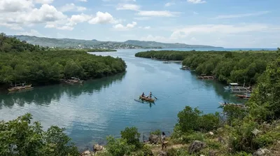
Silut Lagoon

자연

Silut Lagoon

Silot Lagoon is a shallow body of water located in the municipality of Liloan, Cebu, the Philippines. It is a lagoon surrounded by mangroves, connected to the Camotes Sea by a narrow outlet called the Liloan River. The lagoon has depths of between 1 and 2 feet and is situated just south of Liloan's poblacion. It is bounded to the east by the village of Catarman, to the west by Yati, and to the south by Tayud. It has sandbars near its outlet at the Liloan River.

여기서 11.1 km

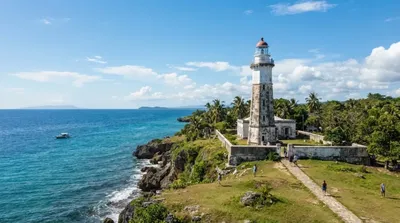
Bagacay Point Lighthouse

전망·랜드마크

Bagacay Point Lighthouse

Bagacay Point Lighthouse is an active lighthouse in Liloan, Cebu, in the Philippines.

여기서 13.1 km

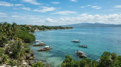
Magellan Bay

자연

Magellan Bay

Magellan Bay is a bay located northeast of Mactan Island, near the city of Lapu-Lapu in the Philippines. The bay is named after the Portuguese explorer Ferdinand Magellan, who was killed in this area by the forces of Lapu-Lapu.

여기서 18.6 km

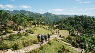
Kan-irag Nature Park

공원·정원

Kan-irag Nature Park

The Kan-irag Nature Park is a watershed and nature park in the uplands of Cebu City, Philippines that opened in the mid-2000s. It was once a bald mountain, but due to reforestation with native trees, the area became a functioning watershed. It is home to about 27 native bird species, such as the emerald dove, Asian glossy starling, the collared kingfisher, the black-naped oriole, and the olive-backed sunbird. The park's size is 71 hectares.

여기서 18.7 km

Central Cebu Protected Landscape

자연

Central Cebu Protected Landscape

The Central Cebu Protected Landscape (CCPL) is a protected area located in the mountains and drainage basins of central Cebu in the Philippines.

여기서 19.1 km

Marcelo Fernan Bridge

전망·랜드마크

Marcelo Fernan Bridge

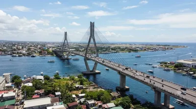
The Marcelo Fernan Bridge, also known as the Second Cebu–Mactan Bridge and locally as the Second Bridge, is an extradosed cable-stayed bridge located in Metro Cebu in the Philippines. It crosses the Mactan Channel, connecting Mandaue in mainland Cebu to Lapu-Lapu City in Mactan Island. It is currently the second-longest cable-stayed bridge in the Philippines after the Cebu–Cordova Link Expressway, which also crosses the Mactan Channel. Before it was named the Marcelo Fernan Bridge, it was called the Consolacion Bridge, owing to its proximity to the municipality of Consolacion, which is 1.6 mil...

여기서 19.6 km