World by City

자연

Marmolada Glacier

Marmolada Glacier

The Marmolada Glacier is located on the mountain Marmolada in the province of Belluno, Italy.

Good, within range.

마르몰라다 빙하란

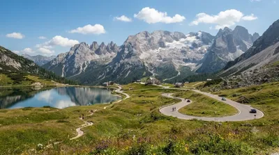
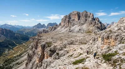
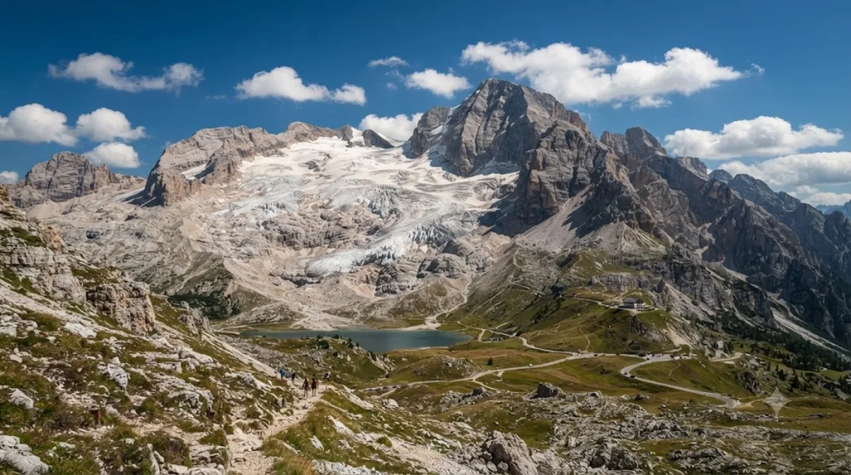
마르몰라다 빙하는 이탈리아 벨루노주 마르몰라다산에 자리한 빙하로, 돌로미티 산군에서 볼 수 있는 대표적인 고산 빙하 지형이다. 여행자들은 눈과 얼음으로 덮인 산 정상부와 주변 암벽 봉우리들이 어우러진 경관을 보기 위해 이곳을 찾으며, 여름철에는 빙하 아래쪽 산길을 따라 걷거나 전망 좋은 지점에서 풍경을 감상할 수 있다.

가는 방법과 소요 시간

돌로미티 지역은 대중교통망이 촘촘하지 않아 렌터카나 셔틀버스를 이용해 산길을 통해 이동하는 것이 일반적이다. 가장 가까운 관문은 파소 페다이아로, 이곳까지 차량으로 이동한 뒤 도보로 빙하 인근까지 접근한다. 베네치아 마르코폴로 공항(VCE)에서는 산길을 포함해 차량으로 두 시간 반 이상, 인스브루크 공항(INN)에서는 이보다 짧게 소요되는 편이다.

머무는 시간

주차 지점에서 전망 포인트까지 짧게 다녀오는 정도라면 한두 시간이면 충분하지만, 주변 산길을 따라 걷거나 사진을 찍으며 여유 있게 둘러본다면 반나절 정도를 잡는 것이 좋다.

방문 시기

고지대 산길인 만큼 겨울철에는 적설과 결빙으로 접근이 어려울 수 있어 여름과 초가을이 이동하기 수월하다. 다만 이 시기는 돌로미티를 찾는 여행객이 몰리는 성수기와 겹쳐 파소 페다이아 인근 도로와 주차 공간이 혼잡할 수 있으므로, 이른 아침에 이동하는 편이 좋다.

함께 둘러보기

  • 파소 페다이아(약 2.4km): 가장 가까운 고개로, 호수와 함께 마르몰라다를 정면으로 볼 수 있는 지점이다.
  • 피츠 보에(약 8.2km): 조금 더 이동해 다른 각도의 돌로미티 능선을 볼 수 있다.
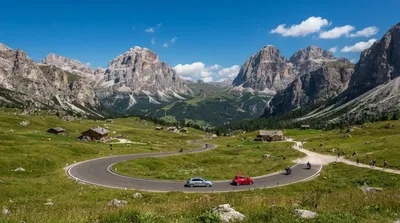
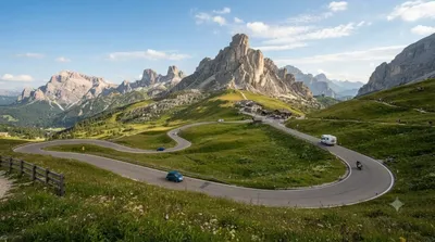
  • 산 펠레그리노 고개(약 8.6km)와 캄폴롱고 고개(약 9km): 산길 드라이브 코스에 함께 넣기 좋은 인근 고개들이다.

출처: 위키백과·OpenStreetMap 공개 자료 · 갱신 2026년 8월 5일 · 편집 World by City 편집팀

입장권·투어 예약

입장료와 운영 시간은 자주 바뀌어서 여기 적지 않습니다. 아래에서 지금 판매 중인 티켓과 가격을 확인하세요. 미리 사두면 현장 대기를 줄일 수 있는 곳도 있어요.

검색 결과에 이 장소의 티켓이 없을 수도 있어요. 무료 입장이거나 현장 발권만 하는 곳도 있습니다.

Marmolada Glacier 근처 숙소

걸어서 오갈 수 있는 거리부터 가까운 순으로 정리했어요. 거리는 직선거리 기준입니다.

지도 © OpenStreetMap 기여자. 직선 연결이라 실제 이동 경로와는 다릅니다.

Marmolada Glacier 근처 숙소

숙소 위치·이름은 OpenStreetMap 자료를 기반으로 하며, 가격과 예약 가능 여부는 각 예약 사이트에서 확인해 주세요.

같이 둘러보기 좋은 곳

Passo Fedaia

자연

Passo Fedaia

The Fedaia Pass is a mountain pass traversed by a paved road in the Dolomiti Range in Northern Italy. It lies at the northern base of the Marmolada, the highest peak in the region and the Dolomiti. It is known for its beauty, for Lago Fedaia, and for its use in the Giro d'Italia. It was also used as a location for the 2003 film Italian Job. It is the site of the Fedaia Pass and Marmolada Gletscher ski areas.

여기서 2.4 km

Piz Boè

자연

Piz Boè

Piz Boè is the highest mountain of the Sella group, a mountain range in the Dolomites, Italy. It has an elevation of 3,152 metres (10,341 ft).

여기서 8.2 km

San Pellegrino Pass

자연

San Pellegrino Pass

The San Pellegrino Pass (1918 m) is a high mountain pass in the Italian Dolomites. It connects the municipalities of Moena and Falcade. The ski resort of Trevalli is located at the pass. The area is also popular in summer for rock climbing. The peak of Cima Uomo and Col Margherita stand nearby on the north and the south sides. During World War I Austrian positions were on Cima Uomo while Italian trenches were on Col Margherita.

여기서 8.6 km

Campolongo Pass

자연

Campolongo Pass

The Campolongo Pass (1875 m) is a high mountain pass in the Dolomites in South Tyrol in Italy.

여기서 9.0 km

Dolomiti Superski

자연

Dolomiti Superski

The Dolomiti Superski is a ski area in Italy. Created in 1974, it is spread over an area of about 3,000 km2 in the North-East of Italy, and includes most of the winter ski slopes of the Dolomites. Comprising 12 ski resorts and a total of 1,246 km of slopes, it is the largest ski area in the world. It regularly hosts World Cup alpine skiing and snowboarding races.

여기서 9.0 km

Col di Lana

자연

Col di Lana

The Col di Lana is a mountain of the Fanes Group in the Italian Dolomites. The actual peak is called Cima Lana and situated in the municipality of Livinallongo del Col di Lana in the Province of Belluno, Veneto region.

여기서 10.1 km