World by City

展望・ランドマーク

ラーマ6世橋

Rama VI Bridge
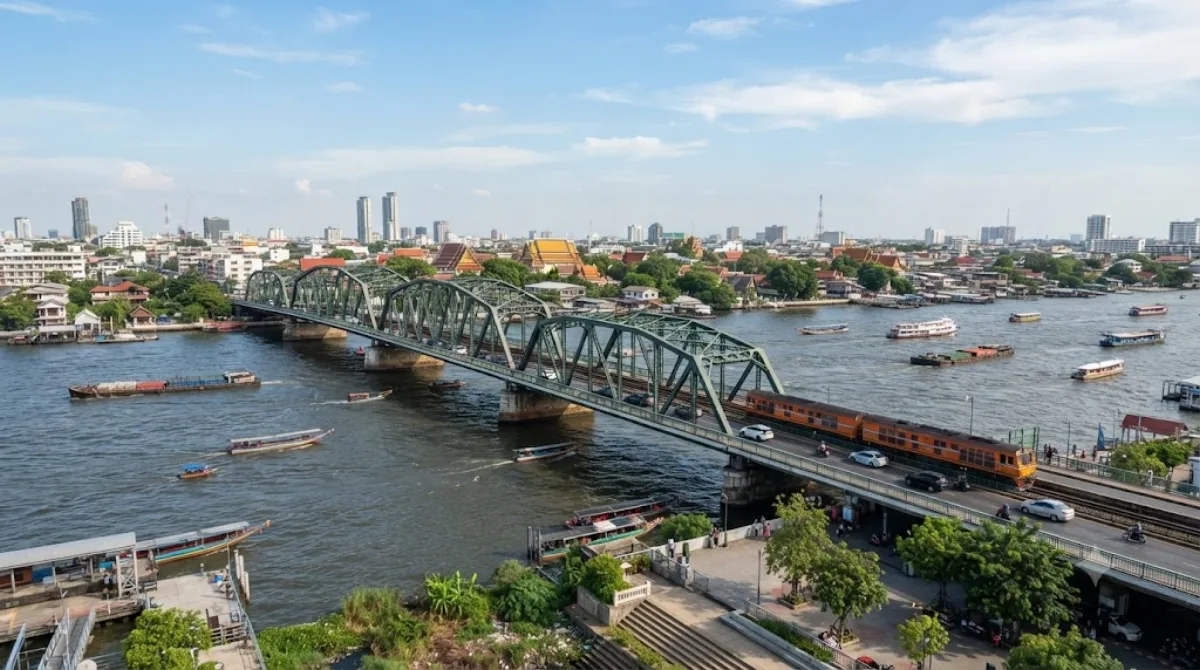
ラーマ6世橋

라마 6세교(태국어: สะพานพระราม 6, RTGS: Saphan Phra Ram Hok)는 태국 방콕의 짜오프라야강을 가로지르는 철도 교량으로, 방쓰와 방플랏 지역을 연결한다.

Rama VI Bridge

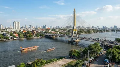
Rama VI Bridge is a railway bridge spanning the Chao Phraya River, linking the Bang Sue and Bang Phlat districts of Bangkok. It carries train traffic rather than being a purpose-built viewpoint, so the appeal for visitors is mostly about seeing the river and the working rail line up close, and photographing the bridge structure itself, rather than any visitor facilities or exhibits.

Getting there

The bridge sits away from the main tourist core, so a taxi or ride-hailing car from central Bangkok is the most practical option, typically taking around 20-30 minutes depending on traffic and which side of the river you're heading to. There is no dedicated tourist entrance, so confirm your drop-off point on the Bang Sue or Bang Phlat side in advance.

Time to allow

Most visitors only need 30-45 minutes here, enough time to walk along the riverbank, take photos, and watch a train cross if one happens to pass.

When to go

Early morning or late afternoon avoids the day's heat and gives better light for photos. As this is an active railway bridge, be mindful of passing trains and stick to public riverside areas rather than the tracks.

Combine with

  • Rama VII Bridge (0.2km) — right next to it, easy to see both bridges in one stop.
  • Queen Sirikit Park (3.8km) — a green space for a break afterward.
  • Chatuchak Weekend Market (4.1km) — worth combining if visiting on a weekend.
  • Dusit Palace (4.4km) — a longer stop for history and architecture nearby.

出典:ウィキペディア・OpenStreetMap の公開データ · 2026年8月5日 更新 · 編集 World by City 編集部

チケット・ツアー予約

入場料や営業時間は変わりやすいためここには載せていません。下で現在販売中のチケットと価格をご確認ください。事前購入で待ち時間を減らせる場所もあります。

検索結果にこの場所のチケットがない場合もあります。入場無料、または現地販売のみの施設もあります。

ラーマ6世橋 周辺の宿

歩いて行ける距離から近い順に並べています。距離は直線距離です。

地図 © OpenStreetMap 寄稿者。直線でつないでいるため実際の経路とは異なります。

ラーマ6世橋 周辺の宿

宿の位置と名称は OpenStreetMap のデータに基づきます。価格と空室は各予約サイトでご確認ください。

あわせて訪れたい場所

라마 7세교

展望・ランドマーク

라마 7세교

라마 7세교(태국어: สะพานพระราม 7, RTGS: Saphan Phra Ram Chet)는 태국 방콕과 논타부리주를 가로질러 방쓰와 방플랏을 잇는 짜오프라야강의 교량이다. 도로는 각 방향 3차로씩 듀얼 캐리지웨이 구성으로 되어 있다. 이 다리는 프라차티뽁 국왕을 기리기 위해 명명되었다. 인접한 라마 6세교의 도로 교통량 증가를 완화하기 위해 건설되었다.

ここから 0.2 km

クイーン・シリキット公園

動物園・水族館

クイーン・シリキット公園

シリキット女王公園 は、タイのバンコク・チャトゥチャック区にある植物園。面積は0.22 km²で、チャトゥチャック公園の一画にある。1992年にシリキット王妃の60歳の誕生日を記念して建てられた。蓮の花が咲いている多くの噴水がある。

ここから 3.8 km

チャトチャック・ウィークエンド・マーケット

ショッピング・繁華街

チャトチャック・ウィークエンド・マーケット

チャトチャック・ウィークエンド・マーケット は、タイのバンコク・チャトゥチャック区にある市場。1982年設立。

ここから 4.1 km

ドゥシット宮殿

城・宮殿

ドゥシット宮殿

Dusit Palace is a compound of royal residences in Bangkok, Thailand. The palace was constructed over a large area north of Rattanakosin Island between 1897 and 1901 by King Chulalongkorn. The palace, originally called Wang Suan Dusit or 'Dusit Garden Palace' (วังสวนดุสิต), eventually became the primary place of residence of the King of Thailand, including King Chulalongkorn, King Vajiravudh, King Prajadhipok, King Bhumibol Adulyadej and King Vajiralongkorn. The palace covers an area of over 64,749 square metres (696,950 sq ft) and is dotted between gardens and lawns with 13 different royal res...

ここから 4.4 km

チャトチャック公園

公園・庭園

チャトチャック公園

짜뚜짝 공원(태국어: สวนจตุจักร, RTGS: Suan Chatuchak)은 태국 방콕 짜뚜짝구 남서부 지역에 위치한 공립 공원이다. 공원 아래에 짜뚜짝공원역이 있다. 짜뚜짝 지명의 이름은 이 공원에서 유래되었다.

ここから 4.4 km

ドゥシット動物園

動物園・水族館

ドゥシット動物園

Dusit Zoo or popularly known as Khao Din Wana (เขาดินวนา) and Khao Din (เขาดิน) was a zoo in Bangkok, Thailand. Located at Khao Din Park in Bangkok's Dusit District next to the old parliament house and Dusit Palace, it was the oldest zoo in Thailand.

ここから 4.5 km