World by City

自然

Cuaming Island

Cuaming Island

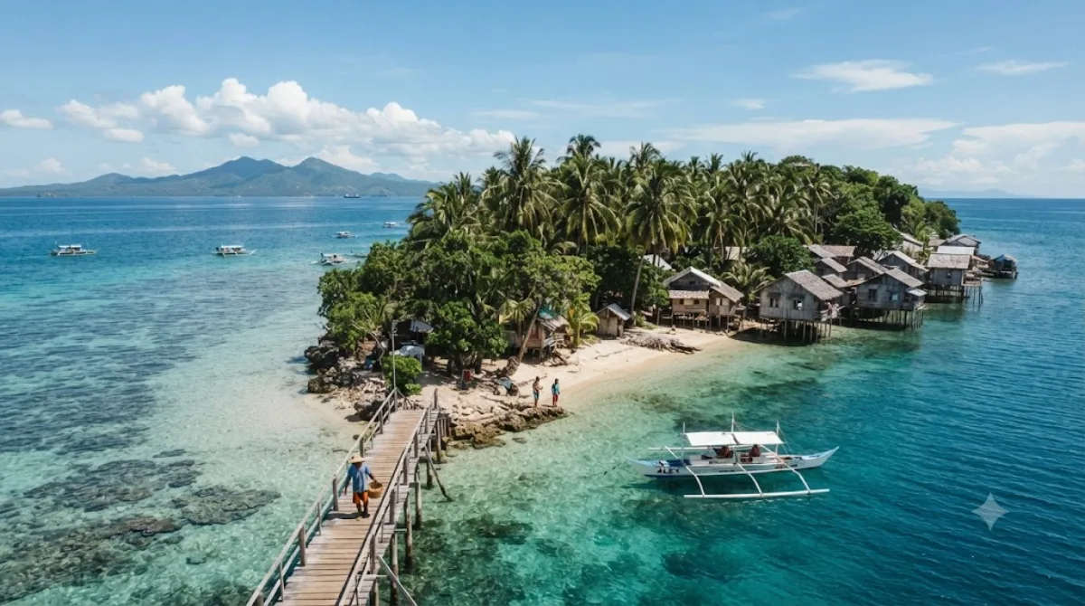
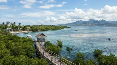
Cuaming is an island located at the Cebu Strait, in the Visayas region, Philippines. It is part of the islands situated in the Danajon Bank, the country's only double barrier reef. The island's residents are mostly dependent entirely on fishing. Cuaming is one of the most densely populated islands in the Philippines.

What it is

Cuaming Island is a small, densely populated fishing island off Cebu, sitting within the Danajon Bank — one of the few double barrier reef systems in the world. There are no major built sights here; the appeal is seeing an actual working fishing community built onto a small reef island, with boats, stilt houses, and daily coastal life. It's a destination for travelers interested in local island life and reef ecosystems rather than resorts or beaches set up for tourists.

Getting there

Cuaming isn't reached directly from Cebu City. You'd typically travel overland to a coastal jump-off point in northern Cebu or Bohol's side of the strait, then take a small boat or arranged banca crossing. There's no scheduled public ferry route commonly used by tourists, so this usually means hiring a boat locally, often coordinated through a nearby mainland town. Expect the land travel plus boat crossing to take a few hours in total, depending on where you start from.

How much time to allow

A few hours is enough to walk around the island and see the settlement and shoreline. Given the effort required to get there, most visitors combine it with a half-day or full-day boat trip covering other nearby islands rather than visiting Cuaming alone.

When to go

Calm weather matters more than season here, since access depends entirely on small boat crossings — avoid going during storms or rough sea conditions. Mornings tend to have calmer water. This is not a crowded tourist spot; it sees far fewer visitors than Cebu's mainstream beach destinations.

Combining with nearby islands

  • Mocaboc Island (7.9km) – the closest option, worth pairing on the same boat trip.
  • Pandanon Island (12.9km) – another Danajon Bank island within reach.
  • Olango Island Group (18.5km) and Olango Island (18.7km) – farther out, better suited to a separate day if arranged from the Mactan side, closer to 막탄 세부 국제공항(CEB).

出典:ウィキペディア・OpenStreetMap の公開データ · 2026年8月5日 更新 · 編集 World by City 編集部

チケット・ツアー予約

入場料や営業時間は変わりやすいためここには載せていません。下で現在販売中のチケットと価格をご確認ください。事前購入で待ち時間を減らせる場所もあります。

検索結果にこの場所のチケットがない場合もあります。入場無料、または現地販売のみの施設もあります。

Cuaming Island 周辺の宿

歩いて行ける距離から近い順に並べています。距離は直線距離です。

地図 © OpenStreetMap 寄稿者。直線でつないでいるため実際の経路とは異なります。

Cuaming Island 周辺の宿

宿の位置と名称は OpenStreetMap のデータに基づきます。価格と空室は各予約サイトでご確認ください。

あわせて訪れたい場所

Mocaboc Island

自然

Mocaboc Island

Mocaboc is an island in the Philippines, situated approximately 14 km (8.7 mi) off the northwest of the island of Bohol. Located in the Cebu Strait, the island is part of the chain of islands situated in the Danajon Bank, the only double barrier reef in the country famous for its rich marine resources. Mocaboc Island is part of the jurisdiction of the municipality of Tubigon, Bohol. Most families of Mocaboc rely on fishing and is known for supplying Ginamos or fermented fish. According to the latest 2024 Census, the total population of Mocaboc is 582. With an estimated area of only 0.02 km2 (0...

ここから 7.9 km

Pandanon Island

自然

Pandanon Island

Pandanon is an island located in the Camotes Sea, in between the islands of Olango and Bohol, in the Visayas Region, Philippines. The island is locally administered by Barangay Pandanon, municipality of Getafe, Bohol. Pandanon is situated in the Danajon Bank, the only double barrier reef in the country and famous for its rich marine wildlife and diversity. It is 9 km (5.6 mi) northwest of the port of Getafe and 13 km (8.1 mi) southeast of Cordova, Cebu. While most of the residents in the island engage in fishing, some are employed in the tourism sector, working in the beach resorts of the isla...

ここから 12.9 km

オランゴ環礁

自然

オランゴ環礁

オランゴ環礁(英: Olango Island Group)はフィリピン中部ビサヤ地方にある群島。環礁となっている。所属する行政府はセブ州ラプ=ラプ市とコルドバに分かれる。マクタン島の5キロメートル東にあり、セブでも有数のリゾート地である。自然保護区としても名高い。

ここから 18.5 km

オランゴ島

自然

オランゴ島

The Olango Island Group is a group of islands found in the Central Visayas region of the Philippines. It comprises Olango island and 6 satellite islets namely: Caubian, Camungi, Caohagan, Gilutongan, Nalusuan, Pangan-an, and Sulpa. The island group has a total land area of approximately 1,030 hectares. It is divided under the jurisdiction of the city of Lapu-Lapu and the municipality of Cordova, Cebu. It lies 5 kilometers (3.1 mi) east of Mactan and is a major tourist destination in Cebu. It is known for its wildlife sanctuary. The entire area is the first declared Ramsar Wetland Site in the P...

ここから 18.7 km

セブ・コルドバ連絡高速道路

展望・ランドマーク

セブ・コルドバ連絡高速道路

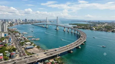
セブ・コルドバ連絡高速道路 は、フィリピンのメトロ・セブにある斜張橋。セブ市とセブ州コルドバ町を結ぶ全長8.9kmの有料高速道路である。マクタン海峡に架かり、セブ島とマクタン島を結ぶ第3の道路であり、セブ市とコルドバをつなぐ最初の道路である。2022年4月27日に開通した、フィリピンで最も長い斜張橋である。セブ・コルドバ橋、第三セブ・マクタンブリッジ とも呼ばれる。

ここから 20.9 km

マクタン島

自然

マクタン島

マクタン島 は、フィリピン中部セブ州にある島である。セブ島の東海岸、セブ市の沖合い数キロのところにあり、セブ島とはマクタン・マンダウエ橋とマルセロ・フェルナン橋、セブ・コルドバ連絡高速道路の三本の橋でつながっている。

ここから 21.0 km