World by City

展望・ランドマーク

방교

Golden Bridge

방교

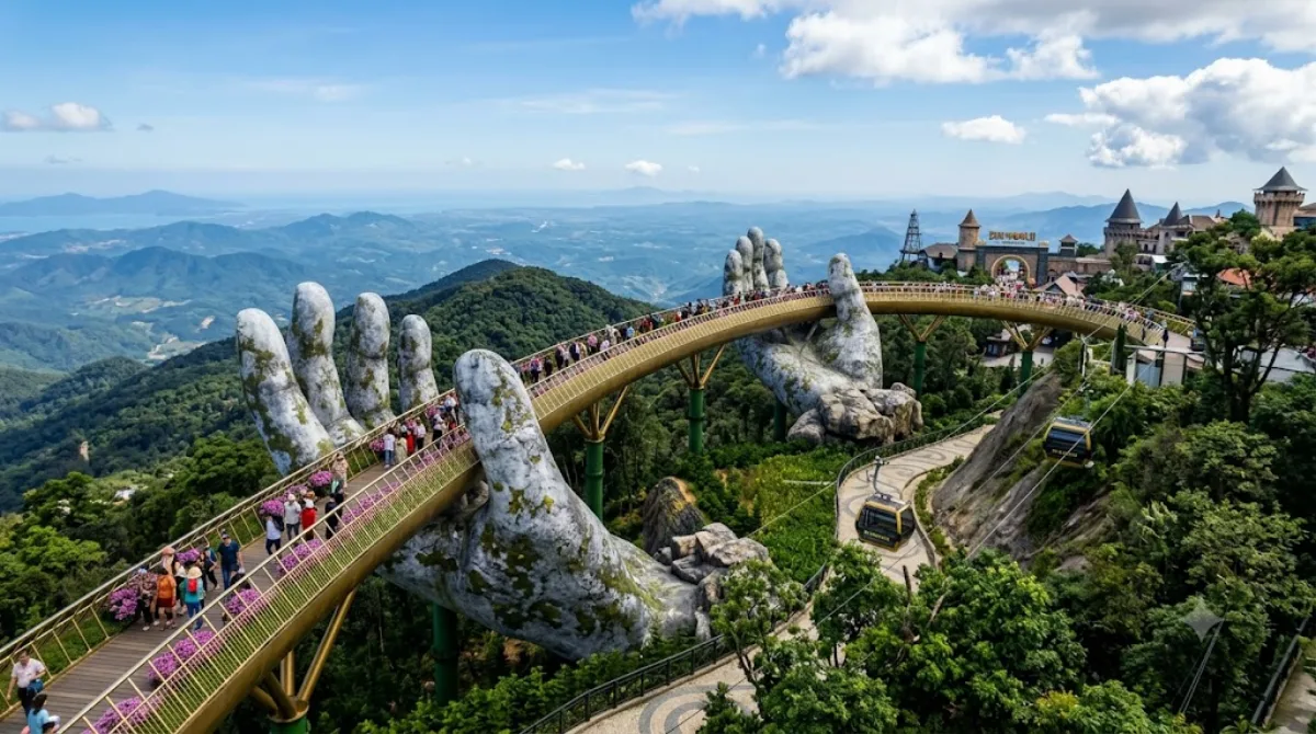
골든 브릿지(베트남어: Cầu Vàng)는 베트남 다낭의 바나힐 리조트에 위치한 150-미터-long (490 ft) 길이의 보행자 교량이다. 이 다리는 케이블카 승강장과 정원을 연결하고(가파른 경사를 피함) 아름다운 전망을 제공하는 관광 명소로 설계되었다. 다리는 스스로를 향해 거의 한 바퀴를 도는 형태를 띠고 있으며, 유리 섬유와 철망으로 제작된 두 개의 거대한 손이 구조물을 떠받치고 있는 돌손처럼 보이도록 디자인되었다.

What it is

The Golden Bridge is a 150-metre pedestrian walkway inside the Bà Nà Hills resort, built to link the cable car station with the hillside gardens above. Its main draw is visual: two enormous fibreglass-and-mesh hands, made to look like weathered stone, appear to cradle the bridge from below. The walkway curves back on itself along the hillside, giving open views over the surrounding forest on clear days. It's a stop within a larger resort, not a standalone site.

Getting there

Bà Nà Hills is roughly 25-30km from central Da Nang, typically 45 minutes to an hour by taxi, private car, or organized tour bus. From the base station, a cable car ride (around 15-20 minutes) carries visitors up the mountain; the Golden Bridge sits near one of the upper stations and is reached on foot from there.

How much time to allow

Walking the bridge itself takes only 10-15 minutes, but most visitors spend several hours in the broader Bà Nà Hills complex, which includes gardens, a hilltop village, and other attractions accessed via the same cable car system. Budget at least half a day once travel time to and from Da Nang is included.

When to go

Mornings tend to be quieter and offer better visibility before afternoon cloud or haze sets in on the mountain. The bridge and surrounding walkways get crowded around midday and on weekends, when tour groups arrive in waves. Mountain weather can shift quickly, so check conditions before heading up, as fog can obscure the views the bridge is known for.

Combining with other sights

The nearby attractions on record are mostly rivers well outside a reasonable side trip from the bridge itself: Yên River (17.9km), Vu Gia river (18.5km), and Cu Đê River (19.9km) are more relevant to travellers exploring Da Nang's countryside separately. Danang Hi-tech Park (12.5km) is the closest, though still a distinct outing rather than a natural pairing. In practice, most visitors treat the Bà Nà Hills resort as a self-contained day trip from the city rather than combining it with other stops along the way.

出典:ウィキペディア・OpenStreetMap の公開データ · 2026年8月5日 更新 · 編集 World by City 編集部

チケット・ツアー予約

入場料や営業時間は変わりやすいためここには載せていません。下で現在販売中のチケットと価格をご確認ください。事前購入で待ち時間を減らせる場所もあります。

検索結果にこの場所のチケットがない場合もあります。入場無料、または現地販売のみの施設もあります。

방교 周辺の宿

歩いて行ける距離から近い順に並べています。距離は直線距離です。

地図 © OpenStreetMap 寄稿者。直線でつないでいるため実際の経路とは異なります。

방교 周辺の宿

宿の位置と名称は OpenStreetMap のデータに基づきます。価格と空室は各予約サイトでご確認ください。

この場所を含む日程

あわせて訪れたい場所

다낭 하이테크 파크

公園・庭園

다낭 하이테크 파크

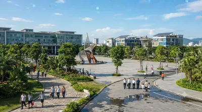
다낭 하이테크 파크(베트남어: Khu công nghệ cao Đà Nẵng, 영어: Danang Hi-tech Park)는 2010년 10월 28일에 발행된 베트남 총리의 1979/QĐ-TTg 결정에 따라 설립되었다. 하노이의 호알락 하이테크 파크와 호찌민의 사이공 하이테크 파크 이후에 세 번째로 설립된 하이테크 파크이다.

ここから 12.5 km

Yên River

自然

Yên River

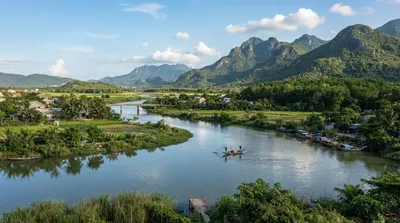
The Yên River, also known as the Thạch Bồ River, is a river of Da Nang, Vietnam. It is formed by the split of the Vu Gia into the Yên and the Bình Phước on the boundary between Đại Lộc commune and Điện Bàn Bắc ward. It flows for 22 kilometres until the boundary between Hòa Vang commune, Hòa Tiến commune, and Cẩm Lệ ward, where it joins the Túy Loan to form the Cầu Đỏ.

ここから 17.9 km

Vu Gia river

自然

Vu Gia river

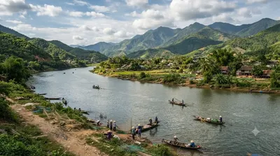
The Vu Gia River is a river in the municipality of Da Nang in central Vietnam. It is formed by the confluence of the Bung and the Cái in Thượng Đức commune. It flows through the communes Thượng Đức, Hà Nha, Vu Gia, and Đại Lộc, until the boundary with Điện Bàn Bắc ward, where it splits into the Yên and the Bình Phước. After the Quảng Huế River branches off, the river is commonly called Ái Nghĩa River. The Vu Gia is part of the Vu Gia–Thu Bồn river basin, and the Vu Gia and the Thu Bồn seasonally undergo exchange of flow.

ここから 18.5 km

クデ川

自然

クデ川

The Cu Đê River, other name Trường Định River is a river of Da Nang, Vietnam.

ここから 19.9 km

Zone 5 Military Museum

博物館・美術館

Zone 5 Military Museum

The Zone 5 Military Museum is a military museum located at 3 Duy Tân, Da Nang, Vietnam. It covers all Vietnamese resistance to foreign occupation from the Chinese occupation, the First Indochina War with the French, the Vietnam War and the current standoff with China over the Spratly Islands and the Paracel Islands.

ここから 24.4 km

Da Nang Bay

自然

Da Nang Bay

Da Nang Bay, formerly known as Tourane Bay, is a bay of the South China Sea along the coast of Da Nang, Vietnam. The bay is entered between the Sơn Trà Peninsula and the Hải Vân Mountain, 4 miles Northwest.

ここから 24.5 km