World by City

公園・庭園

ブキ・ティマ自然保護区

Bukit Timah Nature Reserve
ブキ・ティマ自然保護区

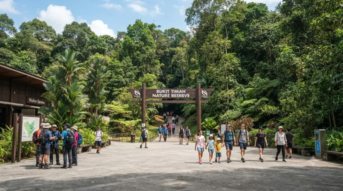
The Bukit Timah Nature Reserve is a nature reserve near the geographic centre of Singapore. It is located on the slopes of Bukit Timah Hill, the country's highest natural peak standing at approximately 165 metres (541 ft), and includes parts of the surrounding area within the planning area of Bukit Panjang. The nature reserve sits about 15 kilometres north-west from the Central Area, Singapore's city-centre, and is roughly 2 km2 (0.77 sq mi) in size.

What it is

Bukit Timah Nature Reserve protects the slopes of Bukit Timah Hill, Singapore's highest natural peak at around 165 metres. It's one of the few patches of primary rainforest left on the island, and the appeal is straightforward: forest trails, canopy and birdlife you won't find in the city's manicured parks, and a summit walk that gives a real sense of elevation change, which is unusual in a country this flat.

Getting there

The reserve sits roughly in the geographic centre of Singapore, about 15 km northwest of the Central Area. By taxi or ride-hailing from downtown, expect around 20-30 minutes depending on traffic. Public transport involves a bus connection from the nearest MRT stations and takes closer to 45 minutes to an hour door to door.

How much time to allow

The main route up to the summit and back takes most visitors 1.5 to 2 hours at a steady walking pace. If you want to explore the longer trails through the surrounding forest rather than just the summit path, allow half a day.

When to go

Go early morning, both to avoid the heat on the uphill sections and because the reserve draws large weekend crowds, especially on the main summit trail. Weekday mornings are noticeably quieter. Wear proper shoes, as the paths can be steep and slippery after rain, which falls year-round in Singapore.

Combining with nearby sights

Singapore Zoo is about 2.3 km away and pairs well as a same-day stop if you're spending the day in the north of the island. Singapore Botanic Gardens, roughly 8.2 km away, offers a gentler, more manicured contrast if you want greenery without the hill trek. Both are reasonable half-day add-ons depending on how much time you spend on the reserve's trails.

出典:ウィキペディア・OpenStreetMap の公開データ · 2026年8月5日 更新 · 編集 World by City 編集部

チケット・ツアー予約

入場料や営業時間は変わりやすいためここには載せていません。下で現在販売中のチケットと価格をご確認ください。事前購入で待ち時間を減らせる場所もあります。

検索結果にこの場所のチケットがない場合もあります。入場無料、または現地販売のみの施設もあります。

ブキ・ティマ自然保護区 周辺の宿

歩いて行ける距離から近い順に並べています。距離は直線距離です。

地図 © OpenStreetMap 寄稿者。直線でつないでいるため実際の経路とは異なります。

ブキ・ティマ自然保護区 周辺の宿

宿の位置と名称は OpenStreetMap のデータに基づきます。価格と空室は各予約サイトでご確認ください。

あわせて訪れたい場所

シンガポール島

自然

シンガポール島

シンガポール島 は、シンガポール共和国のなかで一番大きな島で、本島である。マレー半島の南にあるジョホール海峡を挟んだ対岸にある。マレー半島からは2本の橋(ジョホール・シンガポール・コーズウェイ、マレーシア・シンガポール・セカンドリンク)が架かっており、南部のセントーサ島とも橋で繋がっている。

ここから 0.4 km

シンガポール動物園

動物園・水族館

シンガポール動物園

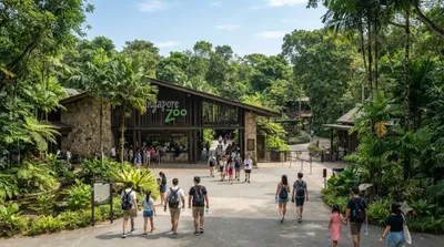
シンガポール動物園 は、シンガポールの中央集水自然保護区にある動物園。地元ではマンダイ・ズー と呼ばれることも多い。面積は28ヘクタールにわたり、1973年にシンガポール政府が900万シンガポールドルを投じて建設した。現在は年間140万人が訪れるシンガポール有数の観光名所の一つとなり絶滅危惧種を含む300種以上の動物が展示されており、開業以来堀など用い動物が逃げ出さないようにするための障壁を観客から隠す「開かれた展示」を行っている。世界最大のオランウータン類の群れを飼育していて、1977年には霊長類学のFrancine Neagoが6ヶ月間に渡るオランウータン類の生態研究を行っている。

ここから 2.3 km

ジョホール・シンガポール・コーズウェイ

展望・ランドマーク

ジョホール・シンガポール・コーズウェイ

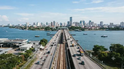
ジョホール・シンガポール・コーズウェイ は、ジョホール海峡を横断してシンガポールのウッドランズ(シンガポール島北部)とマレーシアのジョホール州州都であるジョホールバルを橋で結ぶ土手道である。現地では単にコーズウェイと呼ばれることが多い。本項でも以降「コーズウェイ」と表記する。

ここから 8.1 km

シンガポール植物園

動物園・水族館

シンガポール植物園

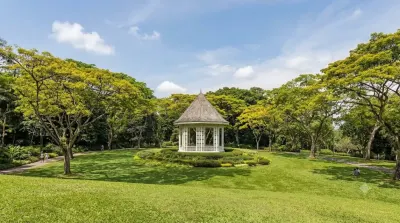
シンガポール植物園 は、シンガポールにある植物園である。英語名のままボタニック・ガーデンと呼ぶこともある。面積82ヘクタールの広さを擁し、ひと回りするには3時間以上かかると言われている。敷地は南北に細長い形をしており、北から順にブキット・ティマ・エリア、中央エリア、タングリン・エリアの3つに区分されている。開園時間は午前5時から夜中の12時までの年中無休で、国立洋ラン園(ナショナル・オーキッド・ガーデン)以外は入場料は必要ない。2015年の第39回世界遺産委員会で世界遺産リストに登録された。初のシンガポールの世界遺産である。

ここから 8.2 km

中台首脳会談

自然

中台首脳会談

中台首脳会談(ちゅうたいしゅのうかいだん)は、2015年11月7日にシンガポールで開催された、中国共産党総書記(最高指導者)の習近平と中華民国総統の馬英九による首脳会談。

ここから 8.9 km

Sultan Abu Bakar Mosque

寺社・宗教施設

Sultan Abu Bakar Mosque

Sultan Abu Bakar State Mosque is the state mosque of Johor, Malaysia. Located along Jalan Skudai, Johor Bahru, the mosque was constructed between 1892 and 1900, under the direction of Sultan Abu Bakar.

ここから 9.6 km