World by City

自然

新店渓

Xindian River
新店渓

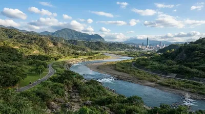
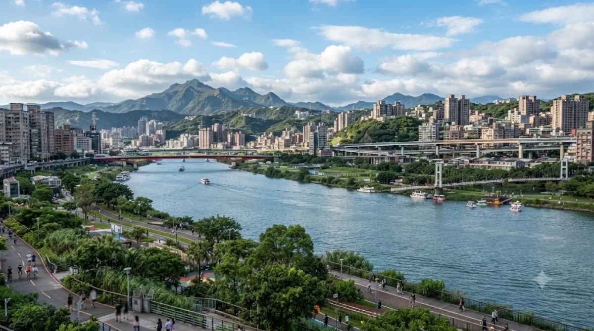
新店渓(しんてん-けい)は、台湾北部を流れる川であり、淡水河の三大支流のひとつである。本川上流部は北勢渓と呼ばれ、新北市双渓区の鶯子嶺を水源とし、西進して新店区に至る。新店区で南勢渓と合流した後は新店渓と呼ばれる。その後は屈尺、直潭などを経て台北市南端の景美で景美渓と合流し、その後は新北市と台北市の境をなす。板橋区江子翠で大漢渓と合流し、淡水河に注ぐ。段丘が発達し、穿入蛇行による切り立った崖が散見される。

Xindian River

The Xindian River runs along the southern edge of central Taipei, marking the boundary between the capital and New Taipei. It's less a single sightseeing stop than a stretch of riverside parkland: paved paths for walking and cycling, open lawns, and views across the water to the hills on the New Taipei side. There are no major landmarks on the river itself, so it works best as a place to walk, cycle, or sit for a while rather than a destination with a specific thing to see.

Getting there

The riverside area near Wanhua is a short trip from central Taipei, generally around 20-30 minutes by MRT or taxi depending on which stretch of the river you're heading to. Bike-share docks are common along the riverside path, and renting a bike in the city and cycling down is also a practical option since the paths connect directly to the river.

How much time to allow

An hour or two is enough for a walk or a short bike ride along the riverside path. If you're cycling further along the network of river paths that link up with other parks, you could easily spend half a day.

When to go

Early morning or late afternoon is more comfortable, especially in summer when the open riverside paths offer little shade. Weekend evenings tend to draw more local cyclists, joggers, and families, so the path can feel busier then; weekday mornings are quieter.

Combine with

  • Dahan River (0.5km) — the two rivers meet nearby, and the riverside paths connect, making it easy to extend a walk or ride between them.
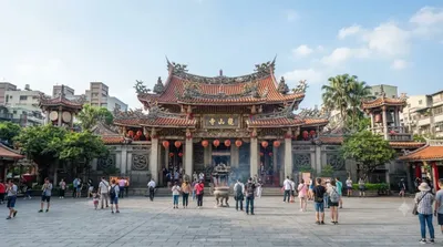
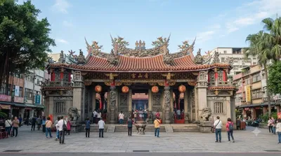
  • Bangka Lungshan Temple (1.6km) and Bangka Qingshan Temple (1.9km) — historic temples in the old Wanhua district, a short trip inland from the riverside.
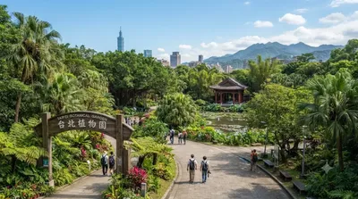
  • Taipei Botanical Garden (2.7km) — a quieter green space worth pairing with a riverside walk.

出典:ウィキペディア・OpenStreetMap の公開データ · 2026年8月5日 更新 · 編集 World by City 編集部

チケット・ツアー予約

入場料や営業時間は変わりやすいためここには載せていません。下で現在販売中のチケットと価格をご確認ください。事前購入で待ち時間を減らせる場所もあります。

検索結果にこの場所のチケットがない場合もあります。入場無料、または現地販売のみの施設もあります。

新店渓 周辺の宿

歩いて行ける距離から近い順に並べています。距離は直線距離です。

地図 © OpenStreetMap 寄稿者。直線でつないでいるため実際の経路とは異なります。

新店渓 周辺の宿

宿の位置と名称は OpenStreetMap のデータに基づきます。価格と空室は各予約サイトでご確認ください。

あわせて訪れたい場所

大漢渓

自然

大漢渓

大漢渓(だいかんけい)は台湾北部を流れる河川。淡水河水系の三大支流のひとつである。旧称は大嵙崁渓。

ここから 0.5 km

艋舺龍山寺

寺社・宗教施設

艋舺龍山寺

龍山寺(りゅうざんじ)は、台湾の寺院。台湾各地に存在するが、本項では台北市万華区に位置する龍山寺を解説する。

ここから 1.6 km

艋舺清水巌

寺社・宗教施設

艋舺清水巌

艋舺清水巌(もうこうせいすいがん)は、台湾台北市万華区に位置する寺院。艋舺祖師廟とも。艋舺龍山寺・大龍峒保安宮と並ぶ「台北の三大廟門」といわれる。また、淡水祖師廟、三峡祖師廟とともに「台北三大祖師廟」とも呼ばれる。

ここから 1.9 km

台北植物園

動物園・水族館

台北植物園

台北植物園 は台湾台北市内中正区にある植物園。市内ではあるがかつての市壁外にあたり、小南門から南東に位置する。台湾における初の植物園で、園内には2,000種を超える植物が収集されている。清代末期の建築物「欽差行台」が移築されており、これも見所のひとつとなっている。

ここから 2.7 km

国立歴史博物館

博物館・美術館

国立歴史博物館

国立歴史博物館 、略称は史博館、は台湾台北市中正区南海学園にある歴史博物館である。中華民国政府の台湾移転以降、最初に設立した公立博物館であり、一部のコレクションは河南博物館(現在の河南博物院)の所蔵品だった。

ここから 2.8 km

台北ツインズ

展望・ランドマーク

台北ツインズ

타이베이 트윈 타워(중국어: 臺北雙星, 영어: Taipei Twins)는 타이완 타이베이시에 제안된 마천루이다. 공사기간은 6년 9개월인데 만약 2027년 12월 31일 완공된다라고 가정하면 늦어도 2021년 3월 31일에는 착공했어야 하지만 현재까지 아무런 정보도 없는 상태이다. 2022년 11월 11일에 드디어 착공하였다.

ここから 3.2 km