World by City

展望・ランドマーク

さっぽろ羊ヶ丘展望台

Hitsujigaoka Observation Hill
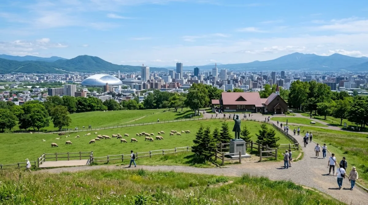
さっぽろ羊ヶ丘展望台

さっぽろ羊ヶ丘展望台 は、北海道札幌市豊平区羊ケ丘にある北海道内でも屈指の観光名所である。南東方向から札幌市街を展望でき、それを背景として腕を伸ばしたウィリアム・スミス・クラーク博士の全身像が展望台内に置かれている風景は有名である。

What it is

Hitsujigaoka Observation Hill is a viewpoint on the southeastern edge of Sapporo, in Toyohira-ku. The main draw is the bronze statue of Dr. William S. Clark, the American educator credited with shaping early Hokkaidō agriculture, whose parting words "Boys, be ambitious" made him a symbol of the region's pioneer spirit. From the hilltop there are open views over the Sapporo plain, with the city skyline in one direction and, on clear days, the surrounding hills and mountains in the other.

Getting there

The hill sits away from central Sapporo, so most visitors take a bus rather than walk. From the city centre, a combination of subway and local bus typically takes around 30-40 minutes, depending on connections. A taxi from downtown is faster but more expensive. It's not within walking distance of the main JR Sapporo Station area.

Time to allow

Most visitors spend around 30-60 minutes here, enough to see the statue, take in the view, and walk around the immediate area.

When to go

Clear weather matters most, since the point of the visit is the view — an overcast or hazy day will make the trip less worthwhile. Winter can bring snow and cold wind exposure on the open hilltop, so dress accordingly if visiting that season. It can draw tour groups around midday, so an early morning or late afternoon visit tends to be quieter.

Combine it with

  • Sapporo Harisutosu Seikyōkai (2.3km) — the closest of the nearby sights, workable as a short add-on.
  • Mount Tenjin (3.4km) — another elevated spot in the same general area.
  • Makomanai Park (3.9km) and Makomanai River (4.1km) — worth pairing together since they're close to each other, if you have a half-day to spend in this part of the city.

出典:ウィキペディア・OpenStreetMap の公開データ · 2026年8月5日 更新 · 編集 World by City 編集部

チケット・ツアー予約

入場料や営業時間は変わりやすいためここには載せていません。下で現在販売中のチケットと価格をご確認ください。事前購入で待ち時間を減らせる場所もあります。

検索結果にこの場所のチケットがない場合もあります。入場無料、または現地販売のみの施設もあります。

さっぽろ羊ヶ丘展望台 周辺の宿

歩いて行ける距離から近い順に並べています。距離は直線距離です。

地図 © OpenStreetMap 寄稿者。直線でつないでいるため実際の経路とは異なります。

さっぽろ羊ヶ丘展望台 周辺の宿

宿の位置と名称は OpenStreetMap のデータに基づきます。価格と空室は各予約サイトでご確認ください。

あわせて訪れたい場所

札幌ハリストス正教会

寺社・宗教施設

札幌ハリストス正教会

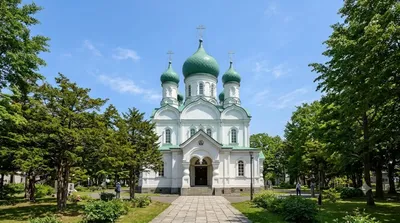
札幌ハリストス正教会(さっぽろはりすとすせいきょうかい)は、日本ハリストス正教会に所属する正教会の教会である。

ここから 2.3 km

天神山

自然

天神山

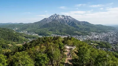
天神山(てんじんやま)とは、北海道札幌市豊平区平岸にある小さな山である。名称の由来は、天満宮を祀ったことによる。

ここから 3.4 km

北海道立真駒内公園

公園・庭園

北海道立真駒内公園

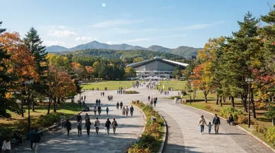
北海道立真駒内公園(ほっかいどうりつまこまないこうえん)は、札幌市南区にある公園。

ここから 3.9 km

真駒内川

自然

真駒内川

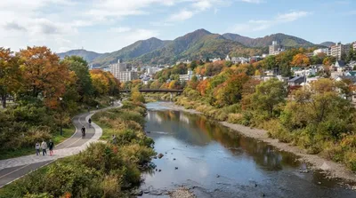
真駒内川(まこまないがわ)は、石狩川水系豊平川の支流で、北海道札幌市南区を流れる河川である。長さ約21 km(キロメートル)、流域面積は約37 km2(平方キロメートル)ある。平均河床勾配1/60の急流であり、下流側15 kmの区間は北海道が管理する一級河川に指定されている。豊平川の支流としては、流路延長約41 kmの厚別川に次いで長い河川である。

ここから 4.1 km

北の沢川

自然

北の沢川

北の沢川(きたのさわがわ)は、北海道札幌市南区を流れる石狩川水系豊平川支流の河川である。元は四号の沢(よんごうのさわ)といい、1941年に北の沢と改称された。札幌市が管理する普通河川に属する。

ここから 4.4 km

末日聖徒イエス・キリスト教会日本札幌神殿

寺社・宗教施設

末日聖徒イエス・キリスト教会日本札幌神殿

예수 그리스도 후기성도 교회 일본 삿포로 성전(일본어: 末日聖徒イエス・キリスト教会日本札幌神殿)은 일본 홋카이도 삿포로시 아쓰베쓰구 오오야치니시 1-6-1에 있는 예수 그리스도 후기 성도 교회의 성전이다. 이 교회에서 지은 성전 중 21세기에 지어진 151번째 성전이다. 오오야치역 인근에 있다.

ここから 5.0 km