World by City

Nature

Sơn Trà Mountain
Open in Maps
Sơn Trà Mountain

What it is

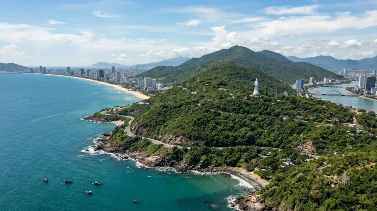
Sơn Trà, often called Monkey Mountain, is a forested peninsula that juts out from Da Nang into the East Sea, forming the north-eastern edge of the bay. It's the largest remaining patch of natural forest close to the city, and it's home to a population of red-shanked douc langurs, a colorful, endangered monkey species you have a reasonable chance of spotting along the upper roads, especially in quieter early-morning hours. The main draw is the drive itself: a winding road through jungle with pull-offs facing the bay, the city skyline, and the open sea, plus a few viewpoints and a lighthouse near the peninsula's tip.

Getting there

From central Da Nang, Sơn Trà is reached by crossing one of the river bridges and following the coastal road north toward the peninsula. By taxi or motorbike, the base of the mountain is roughly 15-20 minutes from the city centre; from there, the climb up to the main viewpoints and the lighthouse adds another 20-30 minutes of driving on switchback roads. There's no public bus route up the mountain itself, so most visitors go by motorbike, taxi, or a hired car with driver.

How much time to allow

Plan on at least half a day if you want to drive the loop road, stop at a few viewpoints, and visit Linh Ung Pagoda. A shorter visit focused on one or two lookout points can be done in about two hours.

When to go

Mornings tend to be cooler and give the best chance of seeing the langurs before they retreat deeper into the forest. The roads are narrow and exposed in places, so heavy rain or fog (more common in the winter months) can make the drive unpleasant and reduce visibility at the viewpoints. Weekends can bring more traffic from local visitors heading up for the views.

What to combine it with

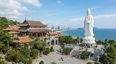
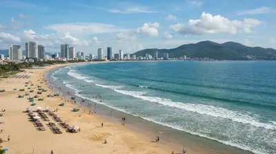
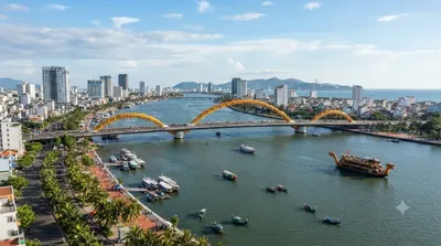
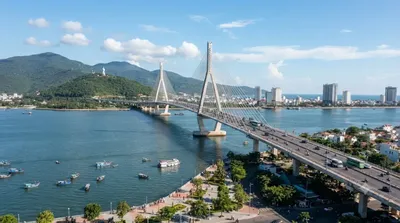
Linh Ung Pagoda sits partway up the mountain, only about 2.5km from the peninsula, and is the easiest add-on to a Sơn Trà trip. On the way back to the city, My Khe Beach (7km) is a natural stop to unwind, and the route passes near the Han River (7.5km) and Thuận Phước Bridge (7.6km), both worth a brief look if you're already driving that stretch of coast.

Updated September 20, 2026 · Edited by the World by City editors

Tickets & tours

Admission prices and opening hours change often, so we don't list them here. Check what's on sale and at what price below — booking ahead can cut the queue at some places.

This place may not appear in the results — some sites are free to enter or sell tickets only at the gate.

Stays near Sơn Trà Mountain

Sorted by distance, walkable ones first. Distances are straight-line.

Map and place data © OpenStreetMap contributors

Sơn Trà Mountain Nearby stays

Check prices and availability on the booking sites.

Pick your dates — we'll search Da Nang hotels for you

Choose dates and guests, and the buttons below will open search results with your criteria. Prices differ between sites, so compare before you book.

Hotel membership

Staying at Accor hotels often? ALL Accor+ Explorer

A paid annual membership. It includes two free nights a year across Asia-Pacific, 30% off dining and 15% off drinks, and 15% off stays at more than 4,500 hotels worldwide.

Explore the membership

Good to visit alongside

Linh Ung Pagoda

Temples & religious sites

Linh Ung Pagoda

Linh Ung Pagoda sits on a hill facing the sea at the foot of the Son Tra Peninsula. It's known for one of the largest statues of the Bodhisattva of Mercy in the Da Nang area — a tall white statue at the highest point of the grounds, facing the sea, offering views of both the city and the coastline. Beyond touring the temple buildings and grounds, this view is the main reason to visit.

2.5 km away

My Khe Beach

Nature

My Khe Beach

My Khe Beach lies east of downtown Da Nang, in the My Phuoc area of Son Tra district, offering easy access to the sea without straying far from the city. Known for its wide sandy shore and gentle waves, it draws travelers for swimming, beach walks, and visits to nearby seafood restaurants.

7.0 km away

Han River

Nature

Han River

The Han River flows through the center of Da Nang, formed where the Cam Le and Do Toan rivers meet at the junction of the Hoa Xuan, Ngu Hanh Son, and Hoa Cuong areas. It then runs about 9.8 km north through downtown, passing under six bridges before emptying into Da Nang Bay.

7.5 km away

Thuận Phước Bridge

Views & landmarks

Thuận Phước Bridge

Thuan Phuoc Bridge is a suspension bridge spanning the mouth of the Han River, where it meets the sea in Da Nang. Unlike the bridges further upstream, it sits right where the river meets Da Nang Bay, offering views of the river and city skyline on one side and the sea and Son Tra Peninsula coastline on the other. Travelers come to enjoy the scenery while driving across, or to take in the night view nearby.

7.6 km away

Han River Bridge

Views & landmarks

Han River Bridge

The Han River Bridge (Cầu Sông Hàn) is a cable-stayed bridge spanning the Han River through downtown Da Nang. It was the city's first bridge designed and built entirely by Vietnamese engineers, and it remains the only swing bridge in Vietnam.

8.3 km away

Dien Hai Citadel

Castles & palaces

Dien Hai Citadel

Dien Hai Citadel is a fortress built in the early 19th century by the Nguyen Dynasty to defend the Da Nang riverfront, known as the site where Vietnamese forces resisted the invading Franco-Spanish fleet in 1858. Rather than an ornate palace, it's a modest historic site with earthen and brick defensive walls, a few cannons, and commemorative monuments.

8.5 km away