World by City

Natur

Civetta

Monte Civetta
Civetta

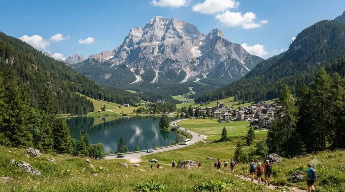
Der Monte Civetta – meist nur Civetta genannt – ist ein 3220 m s.l.m. hoher Berg in den Dolomiten und gibt der Civettagruppe ihren Namen, welche in der italienischen Provinz Belluno liegt.

Monte Civetta

Monte Civetta is one of the large freestanding massifs of the Dolomites, rising above the valley near Alleghe and Taibon Agordino. Its northwest wall is the main draw: a wide, steep rock face that is one of the more recognisable mountain profiles in the range, visited by hikers, climbers and via ferrata enthusiasts as well as people who just want to see it from below or from a nearby refuge.

Getting there

There is no direct public transport to the base of the mountain from a single city centre — most visitors reach it by car via the SR203 road through the Val di Zoldo or Agordo area, then continue on smaller access roads or trails to trailheads such as Palafavera or Listolade. Depending on your starting point in the Dolomites, expect roughly 30–60 minutes of driving to a trailhead, followed by a hike of several hours to reach the mountain itself or its refuges.

Time to allow

A half-day is enough for a short walk with views of the north face. Reaching a refuge on the mountain, or attempting one of the climbing routes, is a full-day undertaking, and multi-day trips are common for those tackling the longer alpine routes.

When to go

The main hiking and climbing season runs from summer into early autumn, when trails and via ferrate are typically free of snow. Mornings tend to offer clearer visibility of the face before afternoon cloud can build up. Trailheads and refuges get busy on summer weekends, so an early start is worth planning for.

Combine with

  • Monte Pelmo (7.6 km) — another major Dolomite peak nearby, often viewed together with Civetta.
  • Giau Pass (11.6 km) — a scenic mountain pass popular for driving or cycling.
  • Col di Lana (13.8 km) — a lower peak with WWI history.
  • Cinque Torri (14.4 km) — distinctive rock towers with open-air war relics.

Quellen: offene Daten von Wikipedia und OpenStreetMap · Aktualisiert 5. August 2026 · Redaktion die World by City-Redaktion

Tickets & Touren

Eintrittspreise und Öffnungszeiten ändern sich häufig und stehen daher nicht hier. Unten sehen Sie, was gerade angeboten wird – vorab buchen spart mancherorts Wartezeit.

Dieser Ort erscheint womöglich nicht in den Ergebnissen – manche Ziele sind kostenlos oder verkaufen nur vor Ort.

Unterkünfte nahe Civetta

Nach Entfernung sortiert, fußläufige zuerst. Angaben als Luftlinie.

Karte © OpenStreetMap-Mitwirkende. Linien sind Luftlinien, keine echten Routen.

Civetta Unterkünfte in der Nähe

Lage und Namen stammen aus OpenStreetMap. Preise und Verfügbarkeit bitte auf den Buchungsseiten prüfen.

Routen mit diesem Ort

Passt gut dazu

Monte Pelmo

Natur

Monte Pelmo

Der Monte Pelmo gehört mit einer Höhe von 3168 m s.l.m. zu den höchsten Gipfeln der Dolomiten und besteht wie für dieses Gebirge typisch aus Dolomit. Er ist zusammen mit dem Monte Rite und anderen Gipfeln einer jener Berge, die das Val di Zoldo vom Valle del Boite und dem Val Fiorentina trennen.

7.6 km entfernt

Passo di Giau

Natur

Passo di Giau

Der Passo di Giau ist ein 2236 m s.l.m. hoher Gebirgspass in den Ampezzaner Dolomiten in den italienischen Alpen. Er liegt im Cadore in der Provinz Belluno und verbindet Cortina d’Ampezzo im Valle del Boite mit Selva di Cadore. Bei entsprechenden Wetterverhältnissen ist die Passstraße SP638 „del Passo di Giau“ auch im Winter geöffnet.

11.6 km entfernt

Col di Lana

Natur

Col di Lana

Der Col di Lana ist ein 2462 m s.l.m. hoher Berg in der Fanesgruppe in den Dolomiten. Er liegt bei Livinallongo del Col di Lana in der Provinz Belluno (Italien).

13.8 km entfernt

Cinque Torri

Natur

Cinque Torri

Die Cinque Torri sind eine bis zu 2361 m s.l.m. hohe Felsformation in den Ampezzaner Dolomiten an der Strecke zwischen dem Falzaregopass und Cortina d’Ampezzo.

14.4 km entfernt

Passo Fedaia

Natur

Passo Fedaia

Der Passo Fedaia oder auch Passo di Fedaia ist ein 2057 m s.l.m. hoher Alpenpass in der zu den Dolomiten zählenden Marmolatagruppe. Der Pass stellt die Verbindung zwischen Canazei im Fassatal und Rocca Pietore im Val Pettorina her.

15.8 km entfernt

Passo di Falzarego

Natur

Passo di Falzarego

Der Passo di Falzàrego ist ein 2105 m s.l.m. hoher Gebirgspass in der italienischen Provinz Belluno.

15.8 km entfernt