Natur
Tagliamento
Der Tagliamento
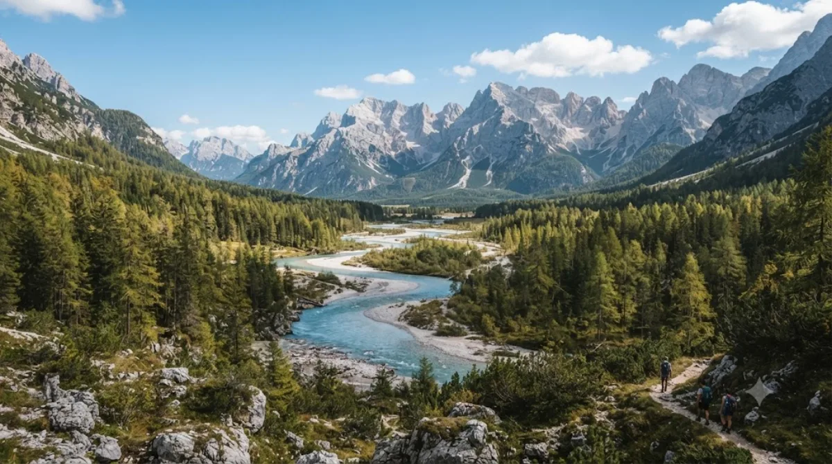
Der Tagliamento ist ein Fluss im Nordosten Italiens, der in den Alpen entspringt und in die Adria mündet. In der Region der Dolomiten präsentiert er sich als verwilderter Fluss mit einem breiten Kiesbett, in dem sich das Wasser in zahlreiche kleine Kanäle aufteilt. Reisende besuchen diesen Ort, um die spezifische Landschaft eines geflochtenen Flusssystems zu beobachten.
Anreise und Dauer
Die Erreichbarkeit hängt vom gewählten Startpunkt in der Region ab. Da der Fluss über eine weite Strecke fließt, erfolgt die Anreise zu den charakteristischen Abschnitten meist per Mietwagen oder lokalem Transport. Von den nächstgelegenen Ortszentren aus ist die Fahrzeit in der Regel kurz und beträgt oft weniger als 30 Minuten.
Für einen Aufenthalt an den Ufern des Flusses sollten etwa zwei bis vier Stunden eingeplant werden, um die verschiedenen Flussarme und das Kiesbett zu erkunden.
Beste Reisezeit
Der Fluss ist ganzjährig zugänglich. Die Wasserführung variiert je nach Saison und Wetterlage stark, was das Erscheinungsbild des Flussbettes verändert. In den Sommermonaten ist mit einem höheren Besucheraufkommen zu rechnen.
Kombinationsmöglichkeiten
In der Umgebung befinden sich weitere Ziele, die mit einem Besuch des Flusses kombiniert werden können:
- Cadore (14,2 km)
- Cima dei Preti (14,2 km)
- Antelao (20 km)
- Zwölferkofel (22,5 km)
Aktualisiert 20. September 2026 · Redaktion die World by City-Redaktion
 GetYourGuide
 Klook
Klook
 Tiqets
 KKday
KKday
 WeGoTrip
 Booking.com
 Hotels.com