World by City

自然

鴨川

Kamo River

鴨川

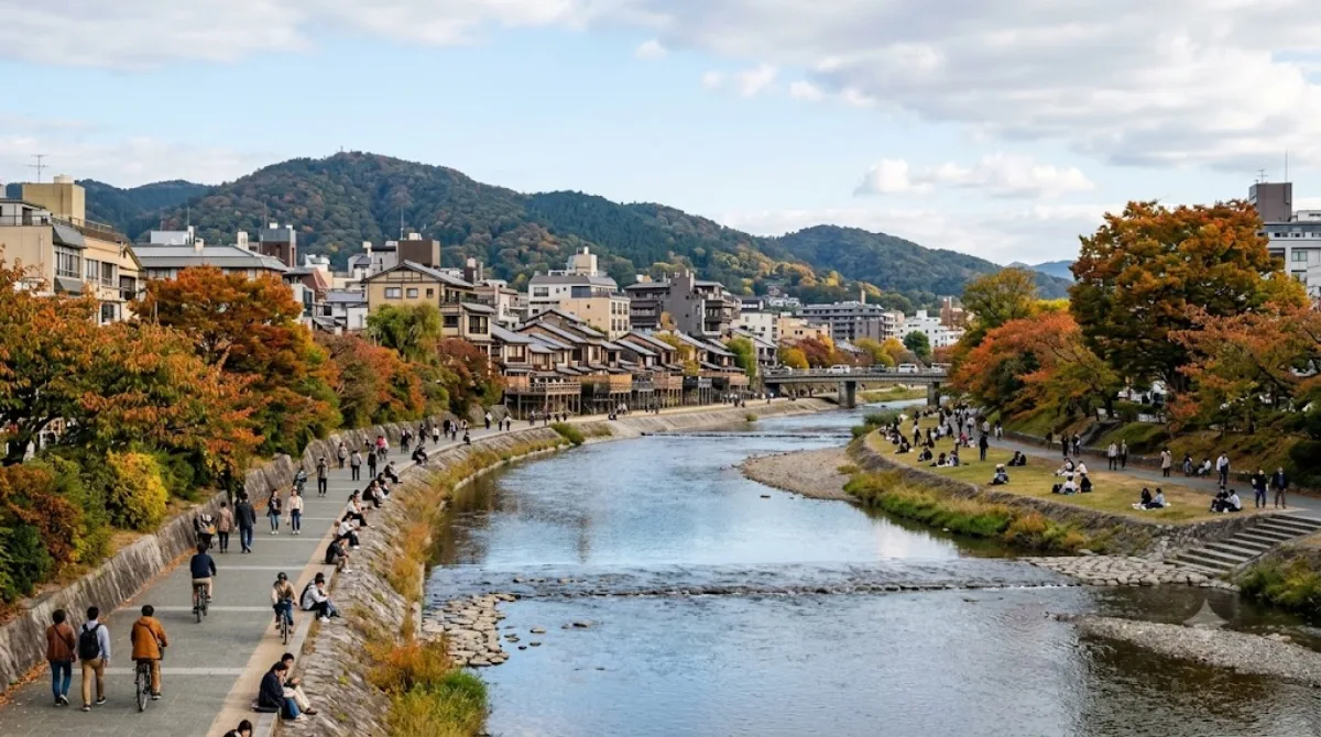
가모가와강(鴨川)은 일본 교토부 교토시를 흐르는 강이다. 길이는 약 31 km이고 유역 면적은 210 km2이다. 강둑은 산책로로서 주민 및 관광객들에게 인기가 있다. 강의 깊이는 대부분 얕아서 1 m도 안되는 곳이 많다. 그러나 장마철이 되면 때때로 물이 오솔길까지 넘치기도 한다.

Kamo River

The Kamo River runs through central Kyoto and is one of the easiest ways to get a sense of the city's daily rhythm rather than its temples. Locals jog, cycle, and sit along the banks, and the shallow water and stepping stones make it a place to linger rather than just pass through. In summer, restaurants along the western bank (particularly around Pontochō and Gion) build wooden platforms, called yuka, over the water, so you can eat outdoors above the river.

Getting there

The riverbanks are within walking distance of downtown Kyoto — the stretch near Shijō and Sanjō, close to Gion and Pontochō, is the most central and easiest to reach on foot or by a short bus or subway ride from Kyoto Station.

How much time to allow

A stroll along the banks can take anywhere from 20 minutes to a couple of hours, depending on whether you're just crossing the stepping stones or walking a longer stretch. If you're stopping for a meal at one of the riverside restaurants, allow at least an hour beyond the walk itself.

When to go

Early morning and evening are quieter and more comfortable, especially in summer heat. The riverside can get crowded at sunset, when both locals and visitors gather to walk or sit along the banks. During the rainy season, the lower walkways can flood, so check conditions before planning a walk close to the water.

Combine it with

  • Fushimi Castle, about 3.7km away
  • Fushimi Inari-taisha, about 5.2km away
  • Tō-ji Temple, about 5.5km away
  • Tōfuku-ji Temple, about 5.9km away

These are all a taxi or short train ride from the riverside, making the Kamo River a reasonable stop on the way to or from Fushimi's shrines and temples.

出典:ウィキペディア・OpenStreetMap の公開データ · 2026年8月5日 更新 · 編集 World by City 編集部

チケット・ツアー予約

入場料や営業時間は変わりやすいためここには載せていません。下で現在販売中のチケットと価格をご確認ください。事前購入で待ち時間を減らせる場所もあります。

検索結果にこの場所のチケットがない場合もあります。入場無料、または現地販売のみの施設もあります。

鴨川 周辺の宿

歩いて行ける距離から近い順に並べています。距離は直線距離です。

地図 © OpenStreetMap 寄稿者。直線でつないでいるため実際の経路とは異なります。

鴨川 周辺の宿

宿の位置と名称は OpenStreetMap のデータに基づきます。価格と空室は各予約サイトでご確認ください。

あわせて訪れたい場所

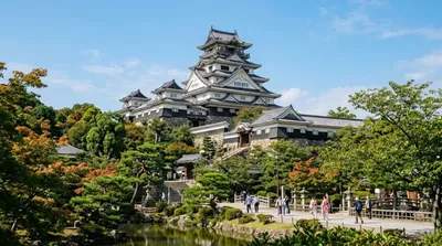
伏見城

城・宮殿

伏見城

후시미성(일본어: 伏見城, ふしみじょう)은 일본 교토부 교토시 후시미구에 있던 성의 이름이다. 현재 그 터에 세워진 후시미 모모야마 성(伏見桃山城)은 근대의 건축물로 후시미 성과는 관계없는 성이다.

ここから 3.7 km

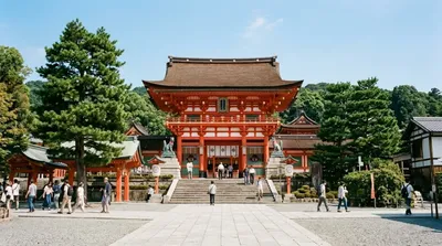
伏見稲荷大社

寺社・宗教施設

伏見稲荷大社

伏見稲荷大社(ふしみいなりたいしゃ)は、京都府京都市伏見区深草薮之内町にある神社。式内社(名神大社)、二十二社(上七社)の一社。旧社格は官幣大社で、現在は単立神社となっている。

ここから 5.2 km

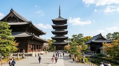
東寺

寺社・宗教施設

東寺

東寺(とうじ)は、京都市南区九条町にある東寺真言宗の総本山の寺院。山号は八幡山。本尊は薬師如来。真言宗の根本道場であり、教王護国寺(きょうおうごこくじ)とも呼ばれる。寺紋は雲形紋(東寺雲)。食堂(本尊・十一面観音)は洛陽三十三所観音霊場第23番札所。

ここから 5.5 km

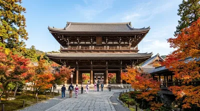
東福寺

寺社・宗教施設

東福寺

東福寺(とうふくじ)は、京都市東山区本町十五丁目にある臨済宗東福寺派の大本山の寺院。山号は慧日山(えにちさん)。本尊は釈迦如来。京都五山の第四位の禅寺として中世、近世を通じて栄えた。近代に入って規模が縮小されたとはいえ、今なお25か寺の塔頭(山内寺院)を有する大寺院である。かつては身の丈五丈の釈迦如来座像を有し、山城国(現在の京都府の一部)では雲居寺大仏・方広寺大仏(京の大仏)に次ぐ高さを有する大仏として、威容を誇っていた。中世においては「南都(東大寺)の半仏雲居(雲居寺)、雲居の半仏東福(東福寺)」「南都の四半仏」と謳われるなど、身の丈十六丈の東大寺大仏・身の丈八丈の雲居寺大仏と並び称されてい...

ここから 5.9 km

桂離宮

城・宮殿

桂離宮

桂離宮(かつらりきゅう)は、京都市西京区桂にある皇室関連施設。江戸時代の17世紀に皇族の八条宮家の別邸として創設された建築群と庭園からなる。総面積は付属地を含め約6万9千平方メートルで、うち庭園部分は約5万8千平方メートルに及ぶ。

ここから 6.4 km

京都タワー

展望・ランドマーク

京都タワー

ニデック京都タワー(ニデックきょうとタワー)は、京都府京都市下京区にある塔である。京阪グループの京阪ホテルズ&リゾーツ株式会社が運営している。後述の通り、ニデックがネーミングライツを取得し2024年4月1日から現在の名前で営業している。

ここから 6.5 km